Photograph as originally submitted to
this page in the Historical Marker Database
www.HMdb.org.
Click on photo to resize in browser. Scroll down to see metadata.
Photographer: HABS - Library of Congress
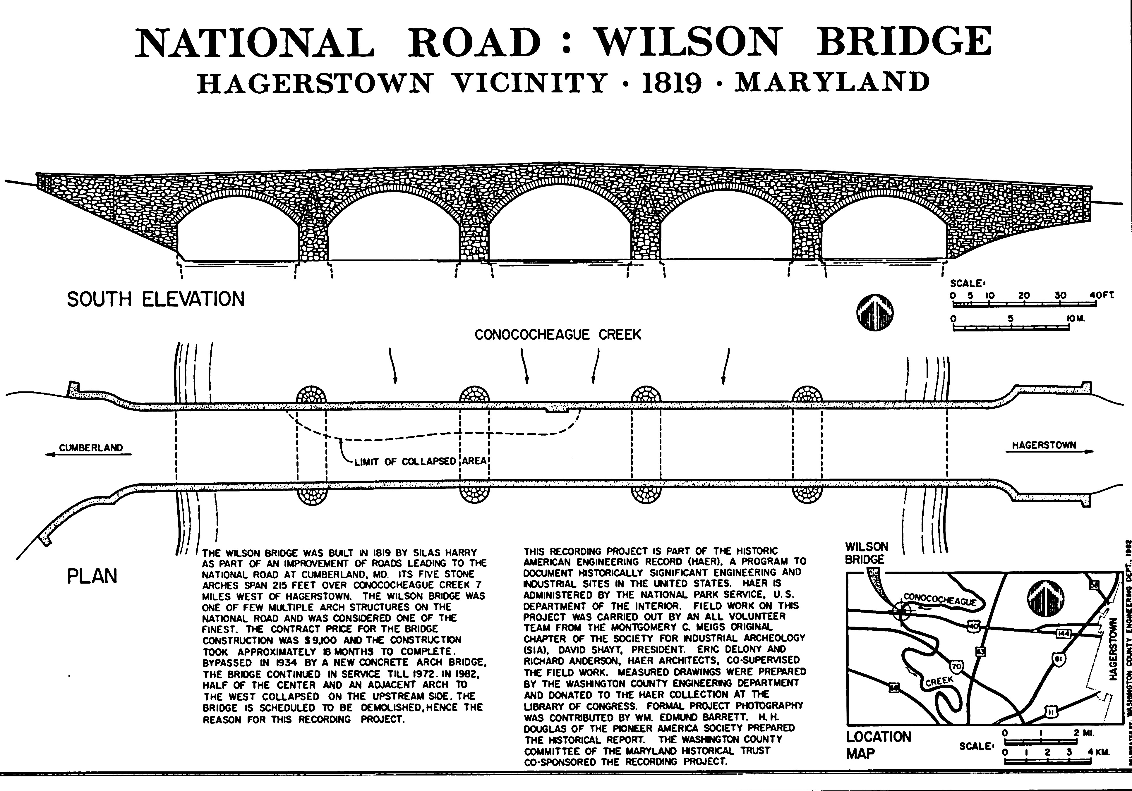
Caption:
Wilson Bridge
South Elevation & Plan view, showing collapsed roadway | Additional Description: “The Wilson Bridge was built in 1819 by Silas Harry as part of an improvement of roads leading to the National Road at Cumberland, MD. Its five stone arches span 215 feet over Conococheaque Creek 7 miles west of Hagerstown. The Wilson Bridge was one of a few multiple arch structures on the National Road and was considered one of the finest. The contract price for the bridge was $9,100 and the construction took approximately 18 months to complete. Bypassed in 1934 by a new concrete arch bridge, the bridge continued in service until 1972. In 1982, half of the center and an adjacent arch to the west collapsed on the upstream side. The bridge is {1983} scheduled to be demolished, hence the reason for this recording project.”
HABS Wilson Bridge Recording ProjectSubmitted: November 1, 2016, by Allen C. Browne of Silver Spring, Maryland.
Database Locator Identification Number: p368058
File Size: 1.791 Megabytes
To see the metadata that may be embedded in this photo, sign in and then return to this page.