Photograph as originally submitted to
this page in the Historical Marker Database
www.HMdb.org.
Click on photo to resize in browser. Scroll down to see metadata.
Photographer: Douglass Halvorsen
Caption:
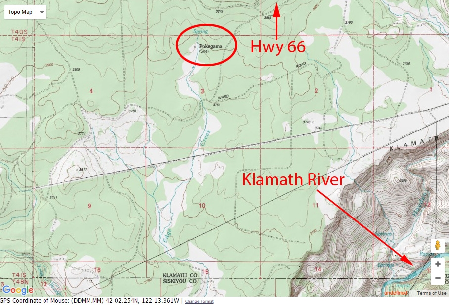
Topography map | Additional Description: This topography map shows the old site of Pokegama (circled in red). Green Springs Hwy (66) is north, Klamath River is to the east, and Keno/Klamath Falls is located to the east.
Submitted: December 8, 2016, by Douglass Halvorsen of Klamath Falls, Oregon.
Database Locator Identification Number: p371848
File Size: 0.297 Megabytes
To see the metadata that may be embedded in this photo, sign in and then return to this page.