Photograph as originally submitted to
this page in the Historical Marker Database
www.HMdb.org.
Click on photo to resize in browser. Scroll down to see metadata.
Photographer: Allen C. Browne
Taken: October 15, 2016
Caption:
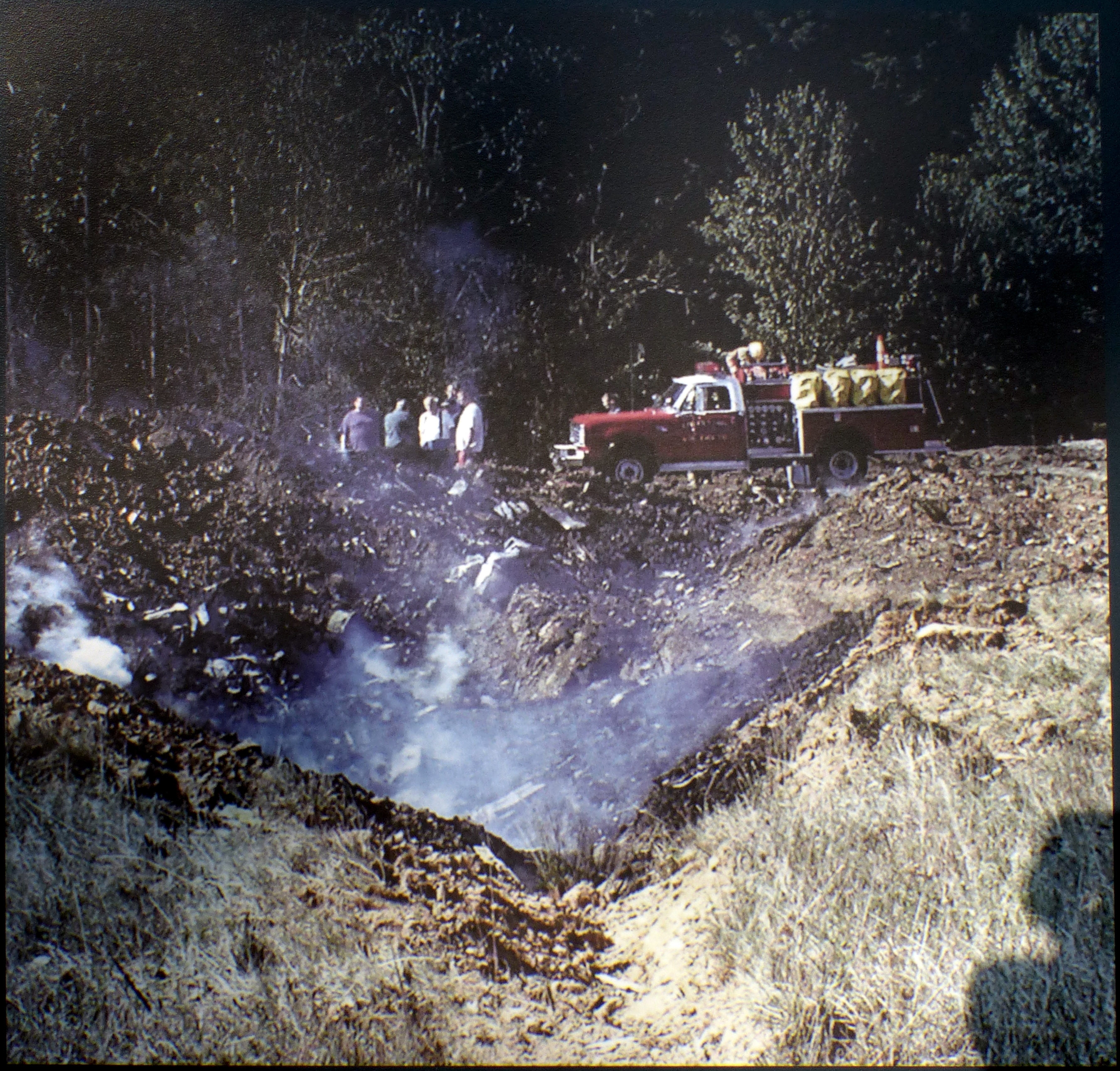
The Crater | Additional Description: First responders and local citizens arrive to find the crash site and adjacent trees still smoldering, and the ground littered with fragments of the plane. The crater is 15 feet deep and roughly 30 feet across.
Close-up of photo on markerSubmitted: December 30, 2016, by Allen C. Browne of Silver Spring, Maryland.
Database Locator Identification Number: p372867
File Size: 1.695 Megabytes
To see the metadata that may be embedded in this photo, sign in and then return to this page.