Photograph as originally submitted to
this page in the Historical Marker Database
www.HMdb.org.
Click on photo to resize in browser. Scroll down to see metadata.
Photographer: J. Makali Bruton
Taken: January 16, 2017
Caption:
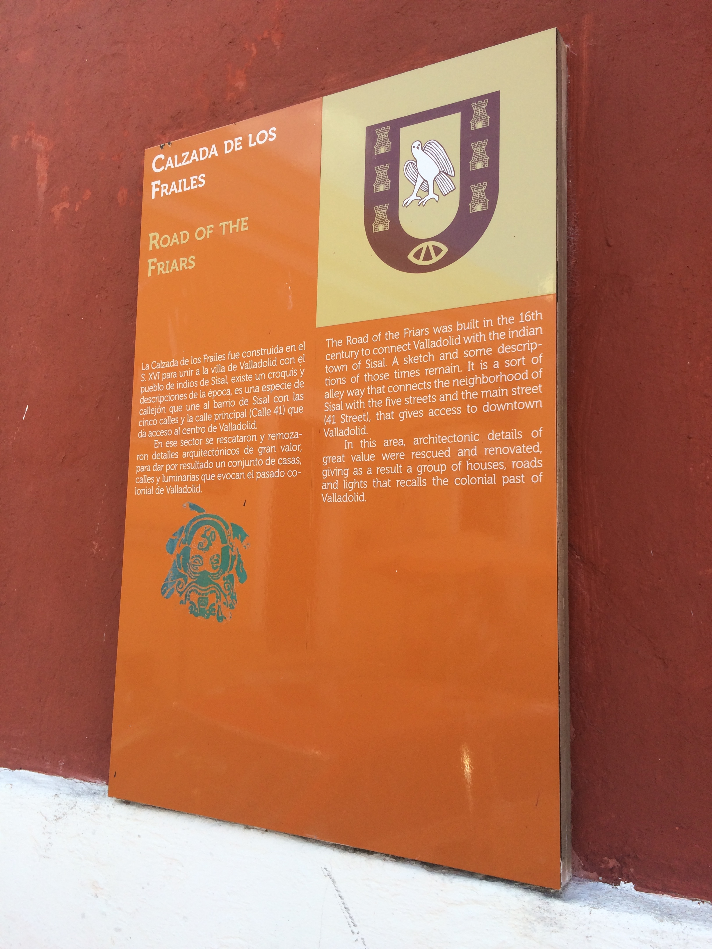
An additional Road of the Friars Marker on the left of the building facing the intersection. | Additional Description: This additional marker, which has slightly shorter text than that of the featured marker, reads:
Calzada de los Frailes
La Calzada de los Frailes fue construida en el S. XVI para unir a la villa de Valladolid con el pueblo de indios de Sisal, existe un croquis y descripciones de la época, es una especie de callejón que une al barrio de Sisal con las cinco calles y la calle principal (Calle 41) que da acceso al centro de Vallodolid.
En ese sector se rescataron y remozaron detalles arquitectónicos de gran valor, para dar por resultado un conjunto de casas, calles y luminarias que evocan el pasado colonial de Valladolid.
English:Road of the FriarsThe Road of the Friars was built in the 16th century to connect Valladolid with the indian town of Sisal. A sketch and some descriptions of those times remain. It is a sort of alley way that connects the neighborhood of Sisal with the five streets and the main street (41 Street), that gives access to downtown Valladolid.
In this area, architectonic details of great value were rescued and renovated, giving as a result a group of houses, roads and lights that recalls the colonial past of Valladolid.
Submitted: March 3, 2017, by J. Makali Bruton of Accra, Ghana.
Database Locator Identification Number: p376267
File Size: 1.924 Megabytes
To see the metadata that may be embedded in this photo, sign in and then return to this page.