Photograph as originally submitted to
this page in the Historical Marker Database
www.HMdb.org.
Click on photo to resize in browser. Scroll down to see metadata.
Photographer: Google Earth Image
Caption:
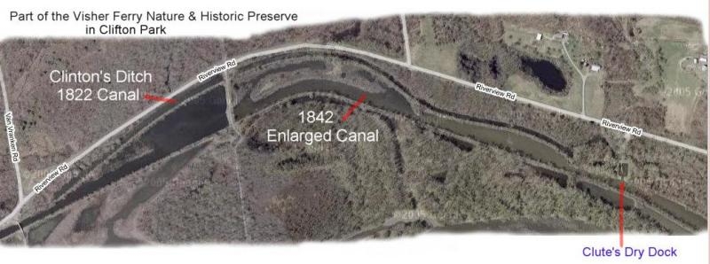
The Erie Canal in Vischer Ferry Nature and Historic Preserve | Additional Description: The Erie Canal marker states that remains from both the original "Clinton's Ditch", dug here in 1822, and the "Enlarged Canal", dug 20 years later in 1842, are Evident. These remains are well illustrated in the aerial view of this section of the preserve.
Submitted: October 5, 2008, by Howard C. Ohlhous of Duanesburg, New York.
Database Locator Identification Number: p37824
File Size: 0.048 Megabytes
To see the metadata that may be embedded in this photo, sign in and then return to this page.