Photograph as originally submitted to
this page in the Historical Marker Database
www.HMdb.org.
Click on photo to resize in browser. Scroll down to see metadata.
Photographer: Kevin W.
Taken: May 14, 2017
Caption:
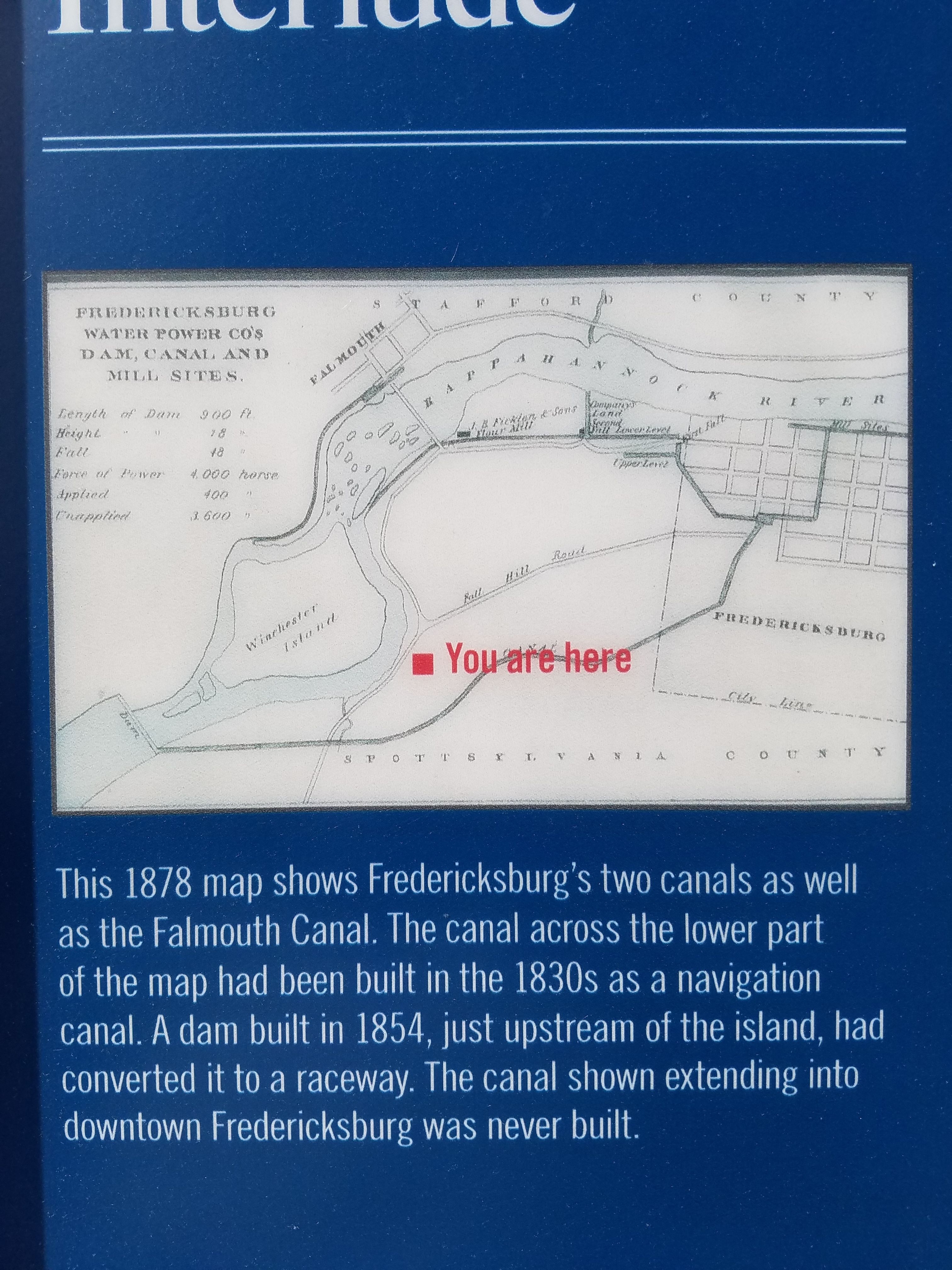
Industrial Interlude Marker | Additional Description: This 1878 map shows Fredericksburg's two canals as well as the Falmouth Canal. The canal across the lower part of the map had been built in the 1830s as a navigation canal. A dam built in 1854, just upstream of the island, had converted it to raceway. The canal shown extending into downtown Fredericksburg was never built.
Submitted: May 19, 2017, by Kevin W. of Stafford, Virginia.
Database Locator Identification Number: p382924
File Size: 4.336 Megabytes
To see the metadata that may be embedded in this photo, sign in and then return to this page.