Photograph as originally submitted to
this page in the Historical Marker Database
www.HMdb.org.
Click on photo to resize in browser. Scroll down to see metadata.
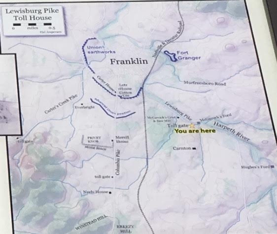
Caption:
Tollhouse Map | Additional Description: The tollhouse stood beside the Lewisburg Pike. During the middle to late 1800s, tollhouses were situated every five miles or so along Tennessee’s turnpikes, many of which are today major highways.
Submitted: May 24, 2017, by Brandon Stahl of Fairfax, Virginia.
Database Locator Identification Number: p383299
File Size: 0.037 Megabytes
To see the metadata that may be embedded in this photo, sign in and then return to this page.