Photograph as originally submitted to
this page in the Historical Marker Database
www.HMdb.org.
Click on photo to resize in browser. Scroll down to see metadata.
Photographer: Joel Seewald
Taken: July 2, 2017
Caption:
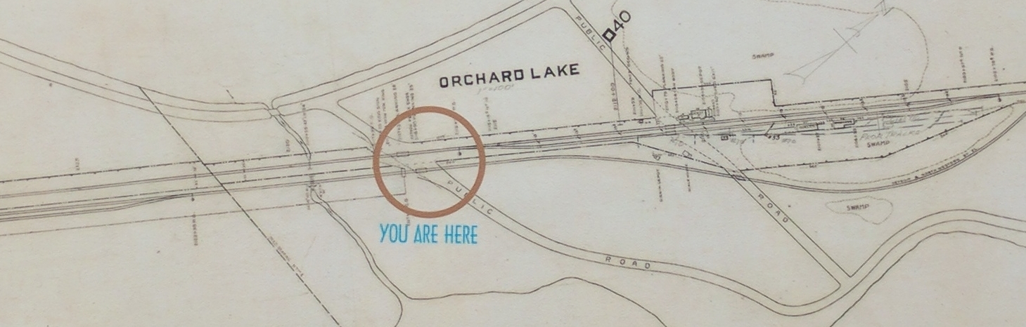
Map (detail) | Additional Description: This 1917 "Orchard Lake Station Map" shows the side-by-side Grand Trunk Railroad track and the electric trolley track that ran through the area. The circle indicates the Orchard Lake Road crossing near where you are standing along the West Bloomfield Trail. Map courtesy of Brian Golden.
Submitted: July 6, 2017, by Joel Seewald of Madison Heights, Michigan.
Database Locator Identification Number: p388071
File Size: 0.422 Megabytes
To see the metadata that may be embedded in this photo, sign in and then return to this page.