Photograph as originally submitted to
this page in the Historical Marker Database
www.HMdb.org.
Click on photo to resize in browser. Scroll down to see metadata.
Photographer: Barry Swackhamer
Taken: June 22, 2017
Caption:
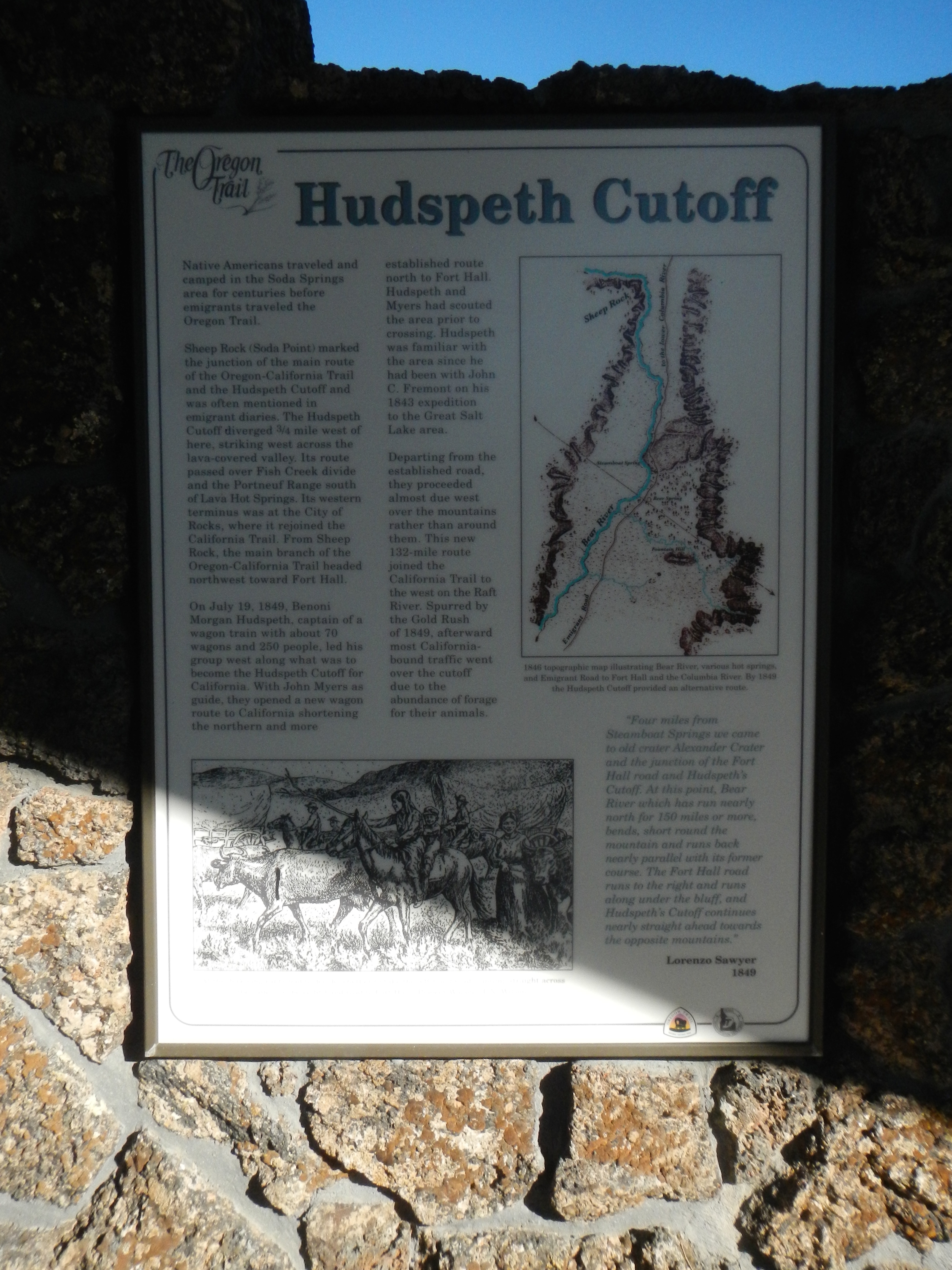
Hudspeth Cutoff Marker | Additional Description: Captions: (top right) 1846 topographic map illustrating Bear River, various hot springs, and Emigrant Road to Fort Hall and the Columbia River. By 1849 the Hudspeth Cutoff provided an alternative route.;
Submitted: August 11, 2017, by Barry Swackhamer of Brentwood, California.
Database Locator Identification Number: p393865
File Size: 3.265 Megabytes
To see the metadata that may be embedded in this photo, sign in and then return to this page.