Photograph as originally submitted to
this page in the Historical Marker Database
www.HMdb.org.
Click on photo to resize in browser. Scroll down to see metadata.
Photographer: J. Makali Bruton
Taken: August 7, 2017
Caption:
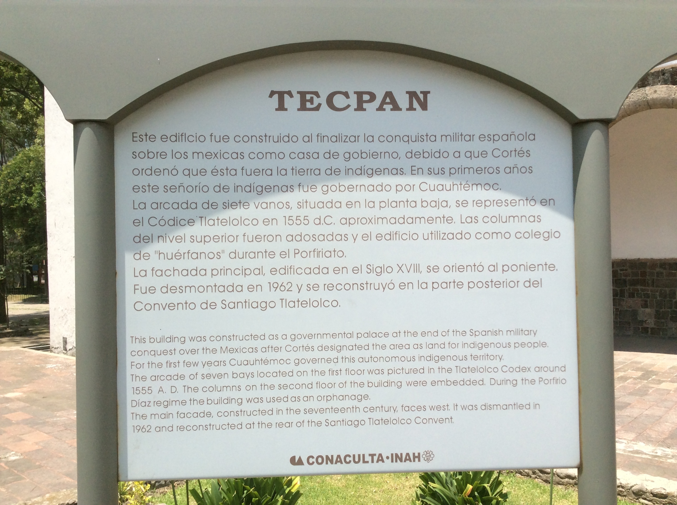
An additional Tecpan marker | Additional Description: This additional marker, with roughly the same information as the featured marker, is some meters to the south. It reads:
TecpanEste edificio fue construido al finalizar la conquista militar española
sobre los mexicas como casa de gobierno, debido a que Cortés ordenó que ésta fuera la tierra de indígenas. En sus primeros años este señorío de indígenas fue gobernado por Cuauhtémoc. La arcada de siete vanos, situada en la planta baja, se representó en el Códice Tlatelolco en 1555 d. C. aproximadamente. Las columnas
del nivel superior fueron adosadas y el edificio utilizado como colegio de "huérfanos" durante el Porfiriato.
La fachada principal, edificada en el Siglo XVIII, se orientó al poniente. Fue desmontada en 1962 y se reconstruyó en la parte posterior del Convento de Santiago Tlatelolco.
English:This building was constructed as a governmental palace at the end of the Spanish military conquest over the Mexicas after Cortés designated the area as land for indigenous people. For the first few years Cuauhtémoc governed this autonomous indigenous territory. The arcade of seven bays located on the first floor was pictured in the Tlatelolco Codex around 1555 A.D. The columns on the second floor of the building were embedded. During the Porfirio Díaz regime the building was used as an orphanage.
The main facade, constructed in the seventeenth century, faces west. It was dismantled in 1962 and reconstructed at the rear of the Santiago Tlatelolco Convent.
Submitted: August 13, 2017, by J. Makali Bruton of Accra, Ghana.
Database Locator Identification Number: p394215
File Size: 1.378 Megabytes
To see the metadata that may be embedded in this photo, sign in and then return to this page.