Photograph as originally submitted to
this page in the Historical Marker Database
www.HMdb.org.
Click on photo to resize in browser. Scroll down to see metadata.
Photographer: Don Morfe
Taken: September 22, 2013
Caption:
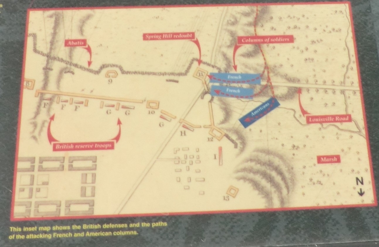
To Arms Marker - close up of map in the lower right | Additional Description:
Caption: This inset map shows the British defenses and the paths of the attacking French and American columns.
Submitted: September 1, 2017, by Don Morfe of Baltimore, Maryland.
Database Locator Identification Number: p397068
File Size: 0.196 Megabytes
To see the metadata that may be embedded in this photo, sign in and then return to this page.