Photograph as originally submitted to
this page in the Historical Marker Database
www.HMdb.org.
Click on photo to resize in browser. Scroll down to see metadata.
Photographer: State of Louisiana
Caption:
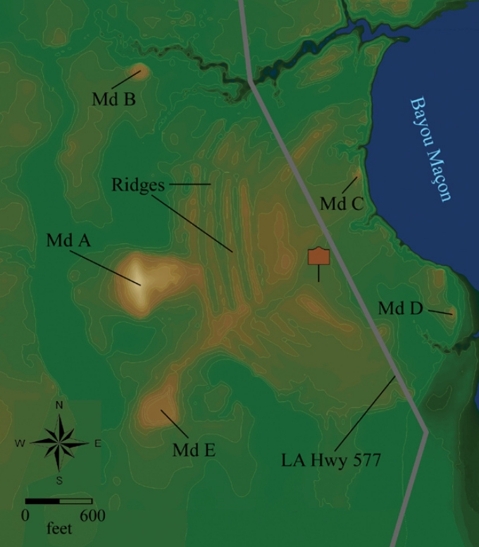
Poverty Point Earthworks map | Submitted: October 27, 2017, by Mark Hilton of Montgomery, Alabama.
Database Locator Identification Number: p401700
File Size: 0.760 Megabytes
To see the metadata that may be embedded in this photo, sign in and then return to this page.