Photograph as originally submitted to
this page in the Historical Marker Database
www.HMdb.org.
Click on photo to resize in browser. Scroll down to see metadata.
Photographer: Library of Congress
Caption:
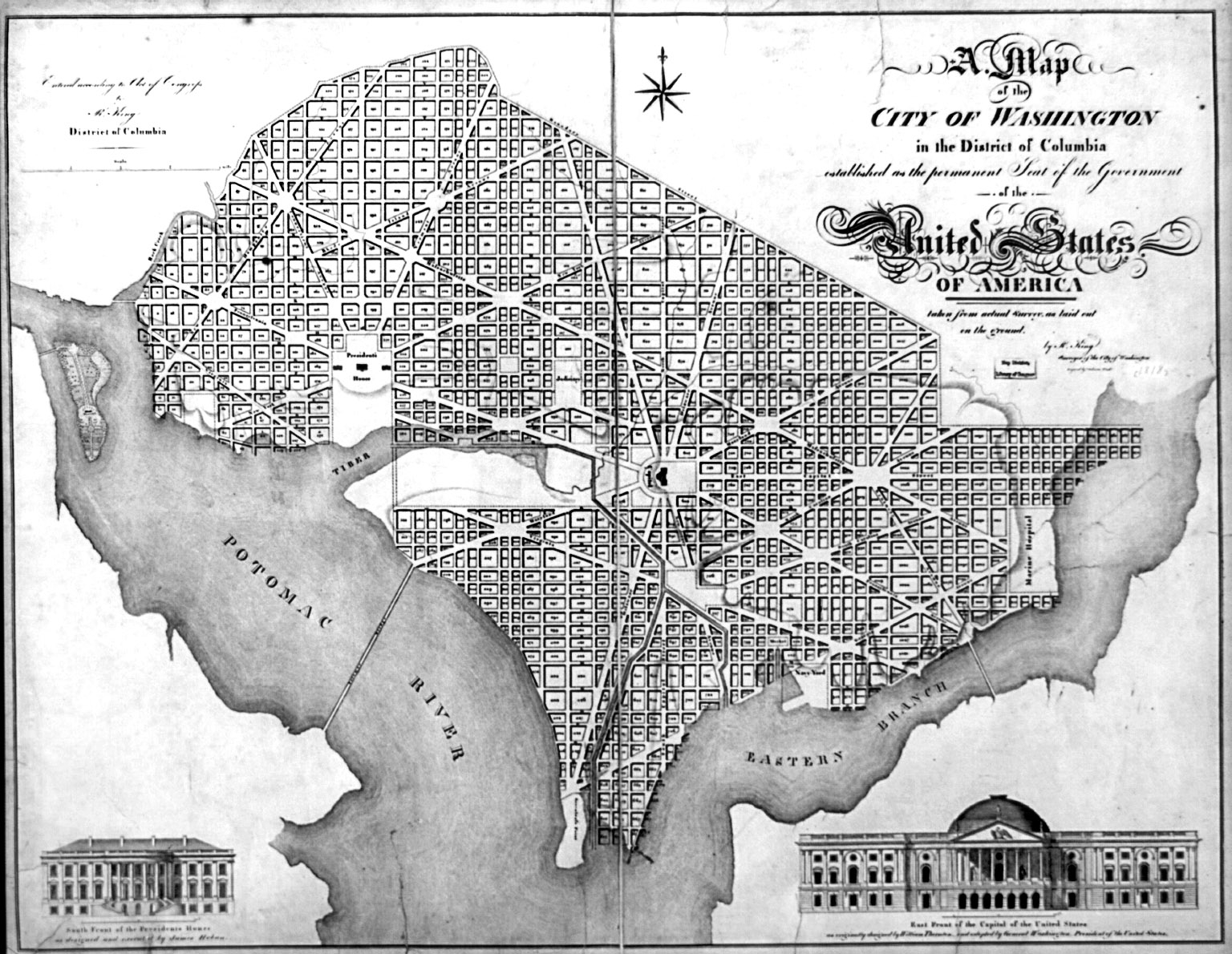
A map of the city of Washington in the District of Columbia, 1818 | Additional Description: This 1818 map of Washington by Robert King shows the Long Bridge between the words “Potomac” and “River”.
Submitted: October 30, 2017, by Allen C. Browne of Silver Spring, Maryland.
Database Locator Identification Number: p402058
File Size: 0.493 Megabytes
To see the metadata that may be embedded in this photo, sign in and then return to this page.