Photograph as originally submitted to
this page in the Historical Marker Database
www.HMdb.org.
Click on photo to resize in browser. Scroll down to see metadata.
Photographer: Barry Swackhamer
Taken: June 24, 2017
Caption:
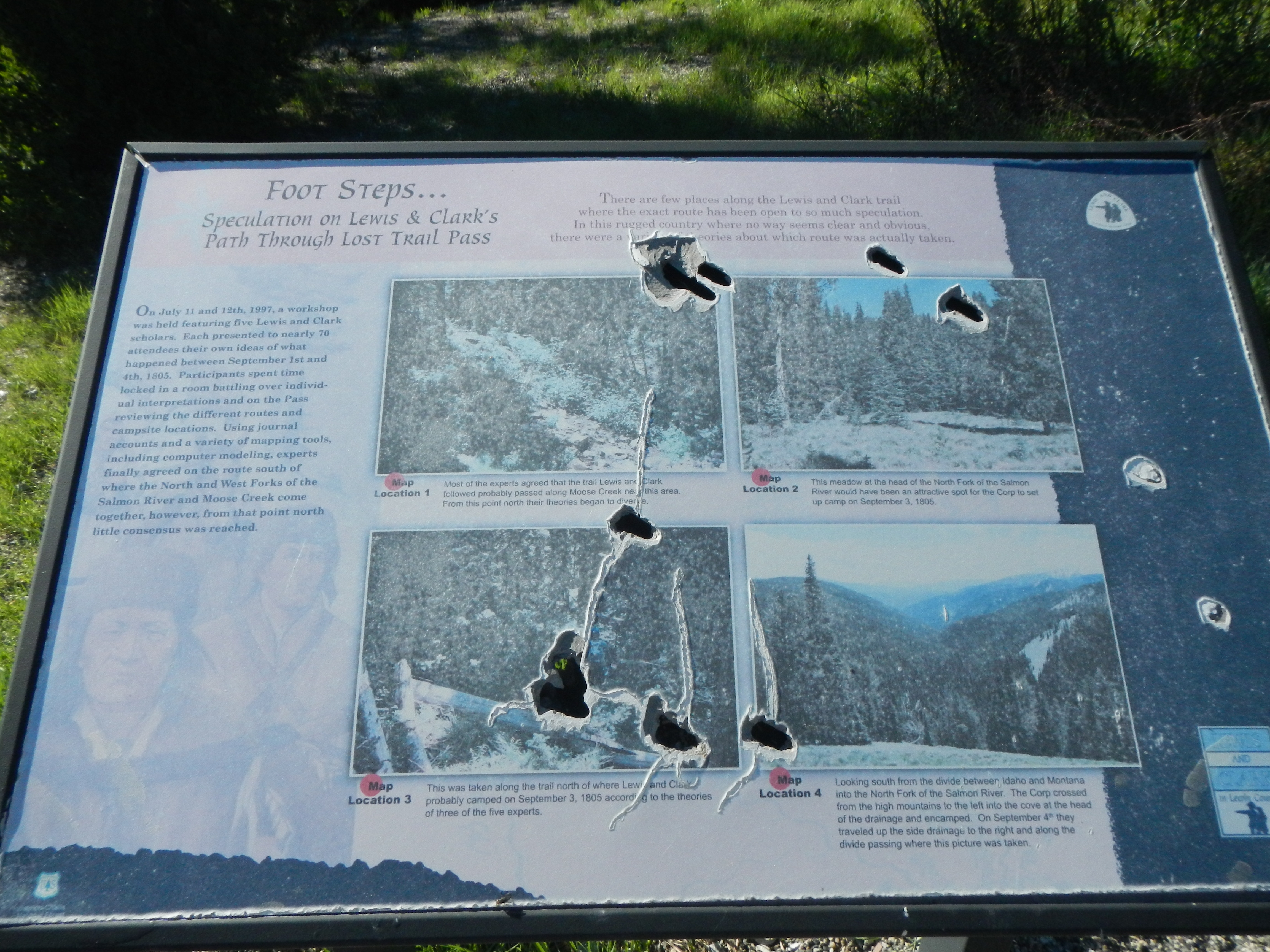
Foot Steps... Marker | Additional Description: Captions: (top left) Map Location 1 Most of the experts agreed that the trail Lewis and Clark followed probably passed along Moose Creek near this area. From this point north their theories began to diverge.; (top right) Map Location 2 This meadow at the end of the North Fork of the Salmon River would have been an attractive spot for the Corp to set up camp on September 3, 1805.; (bottom left) Map Location 3 This was taken along the trail north of where Lewis and Clark probably camped on September 3, 1805 according to the theories of three of the five experts.; (bottom right) Map Location 4 Looking south from the divide between, Idaho and Montana into the North For of the Salmon River. The Corp crossed from the high mountains to the left into the cove at the head of the drainage and encamped. On September 4th they traveled up the side drainage to the right and along the divide passing where this picture was taken.
Submitted: November 5, 2017, by Barry Swackhamer of Brentwood, California.
Database Locator Identification Number: p402699
File Size: 3.360 Megabytes
To see the metadata that may be embedded in this photo, sign in and then return to this page.