Photograph as originally submitted to
this page in the Historical Marker Database
www.HMdb.org.
Click on photo to resize in browser. Scroll down to see metadata.
Photographer: Barry Swackhamer
Taken: September 1, 2017
Caption:
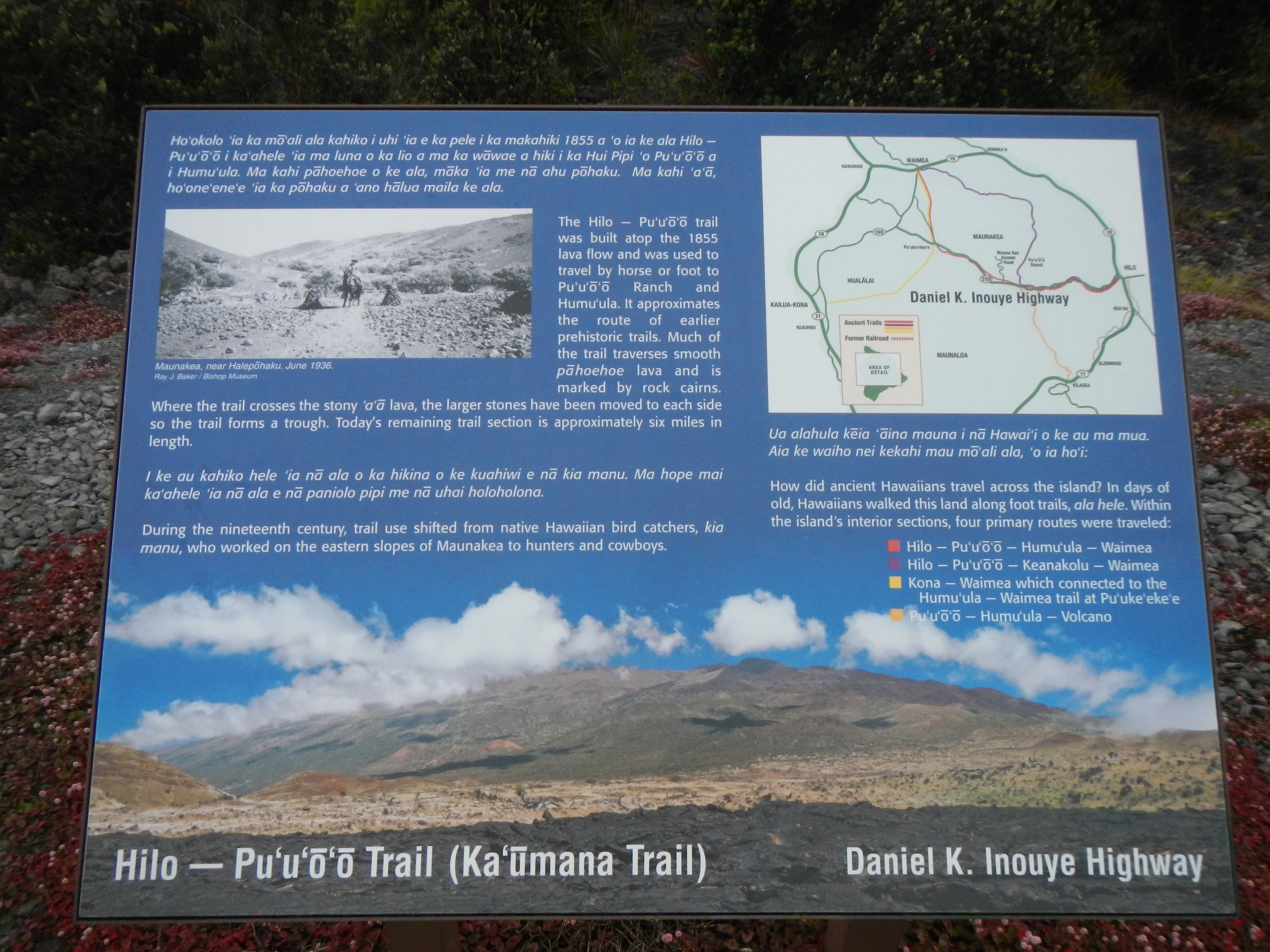
Hilo -- Pu'u'ō'ō Trail (Ka'ūmana Trail) Marker, detail | Additional Description: How did ancient Hawaiians travel across the island? In days of old, Hawaiians walked this land along foot trails, ala hele. Within the islands's interior sections, four primary routes were traveled:
(red) Hilo - Pu'u'ō'ō - Humu'ula - Waimea
(purple) Hilo - Pu'u'ō'ō - Keanakolu - Waimea
(yellow) Kona - Waimea which connected to the Humu'ula - Waimea trail at Pu'uke'eke
(orange) Pu'u'ō'ō - Humu'ula - Volcano
Submitted: November 28, 2017, by Barry Swackhamer of Brentwood, California.
Database Locator Identification Number: p406212
File Size: 3.627 Megabytes
To see the metadata that may be embedded in this photo, sign in and then return to this page.