Photograph as originally submitted to
this page in the Historical Marker Database
www.HMdb.org.
Click on photo to resize in browser. Scroll down to see metadata.
Photographer: Allen C. Browne
Taken: December 18, 2017
Caption:
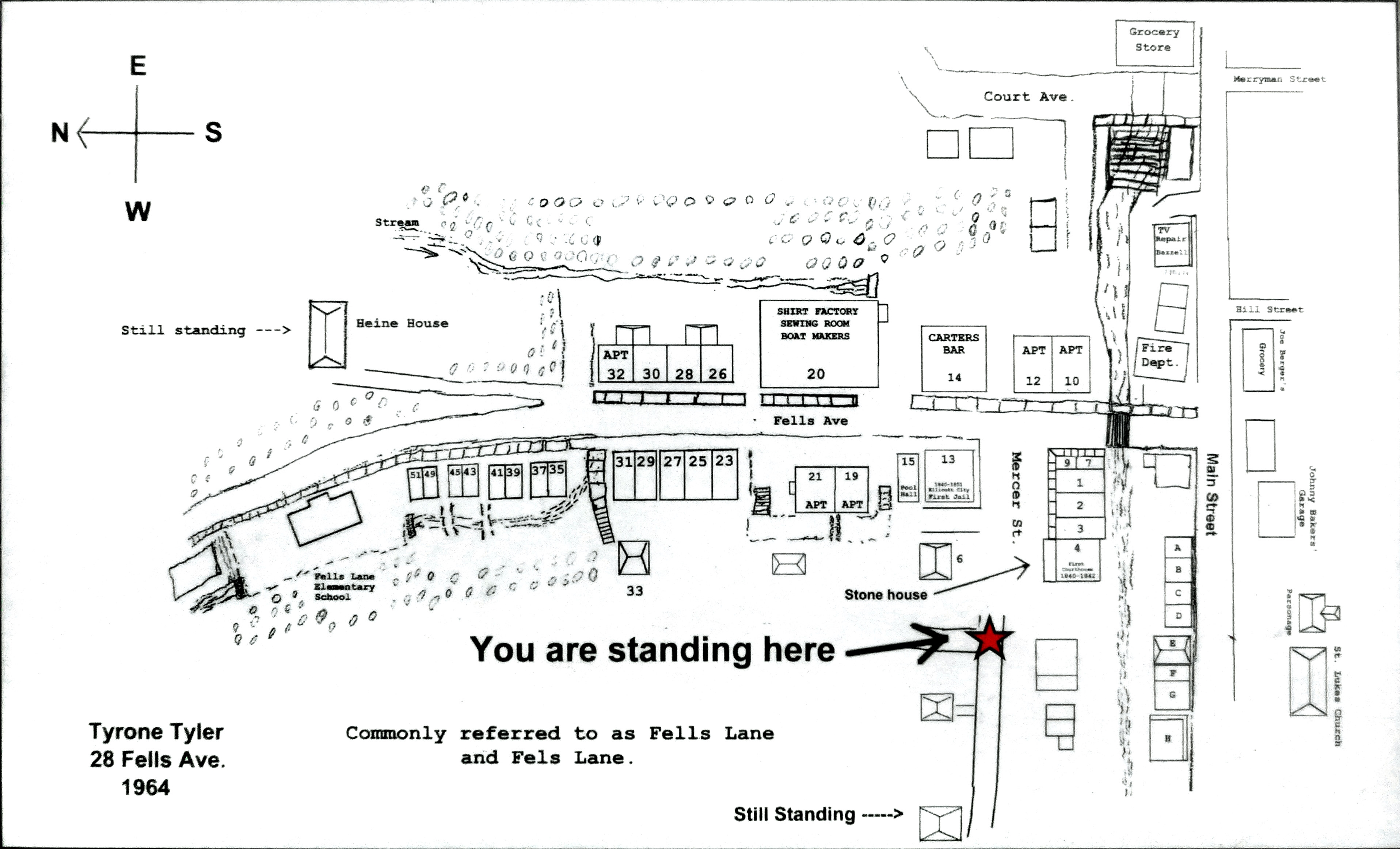
Fells Lane Community | Additional Description: This 1964 neighborhood map, created by former resident Tyrone Tyler, shows the housing layout of the Fells Lane community that existed on what is now Parking Lot F. More than 40 families lived in this area from Main street to the Fells Lane Elementary School.
Close-up of map on markerSubmitted: December 23, 2017, by Allen C. Browne of Silver Spring, Maryland.
Database Locator Identification Number: p409545
File Size: 0.816 Megabytes
To see the metadata that may be embedded in this photo, sign in and then return to this page.