Photograph as originally submitted to
this page in the Historical Marker Database
www.HMdb.org.
Click on photo to resize in browser. Scroll down to see metadata.
Photographer: Barry Swackhamer
Taken: September 21, 2017
Caption:
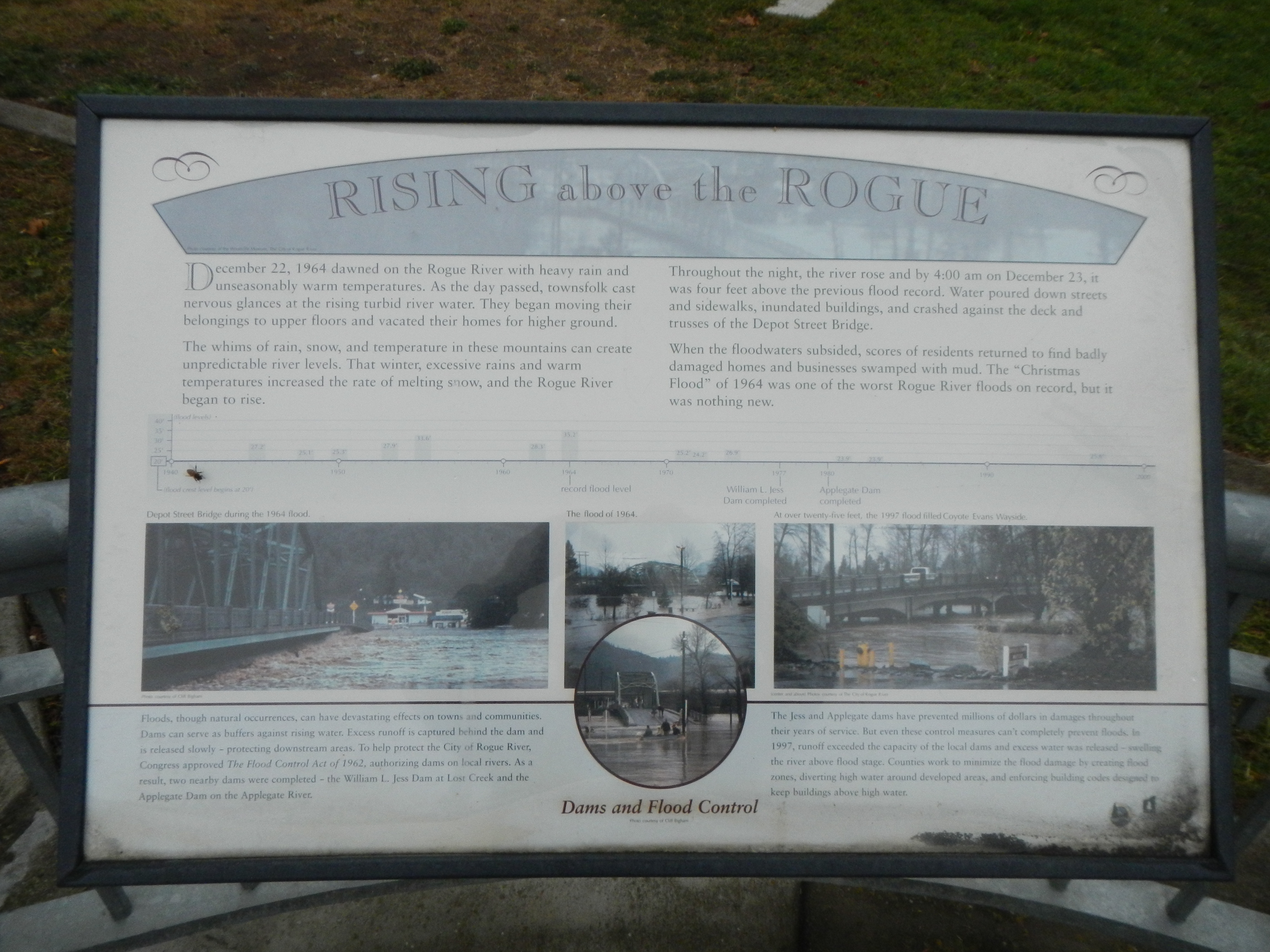
Rising above the Rogue Marker | Additional Description: aptions: (above photographs) Flood level timeline; (center left) Depot Street Bridge during the 1964 flood.; (middle) The flood of 1964; (center right) At over twenty-five feet, the 1997 flood filled Coyote Evans Wayside.; (bottom) Dams and Flood Control: Floods, though natural occurrences, can have devastating effects on towns and communities, Dams serve as buffers agains rising water. Excess runoff is captured behind the dam and is released slowly - protecting downstream areas. To help protect the City of Rogue River, Congress approved
The Flood Control Act of 1962, authorizing dams of local rivers. As a result, to nearby dams were completed - the William L. Jess Dam at Lost Creel and the Applegate Dam on the Applegate River. The Jess and Applegate dams have prevented millions of dollars in damages throughout their years of service. But even these control measures can't completely prevent floods. In 1997, runoff exceeded the capacity of the local dams and excess water was released - swelling the river above flood stage. Counties work to minimize the flood damage by creating flood zones, diverting high water around developed areas, and enforcing building codes designed to keep buildings above high water.
Submitted: January 15, 2018, by Barry Swackhamer of Brentwood, California.
Database Locator Identification Number: p412537
File Size: 3.398 Megabytes
To see the metadata that may be embedded in this photo, sign in and then return to this page.