Photograph as originally submitted to
this page in the Historical Marker Database
www.HMdb.org.
Click on photo to resize in browser. Scroll down to see metadata.
Photographer: Devry Becker Jones (CC0)
Taken: January 27, 2018
Caption:
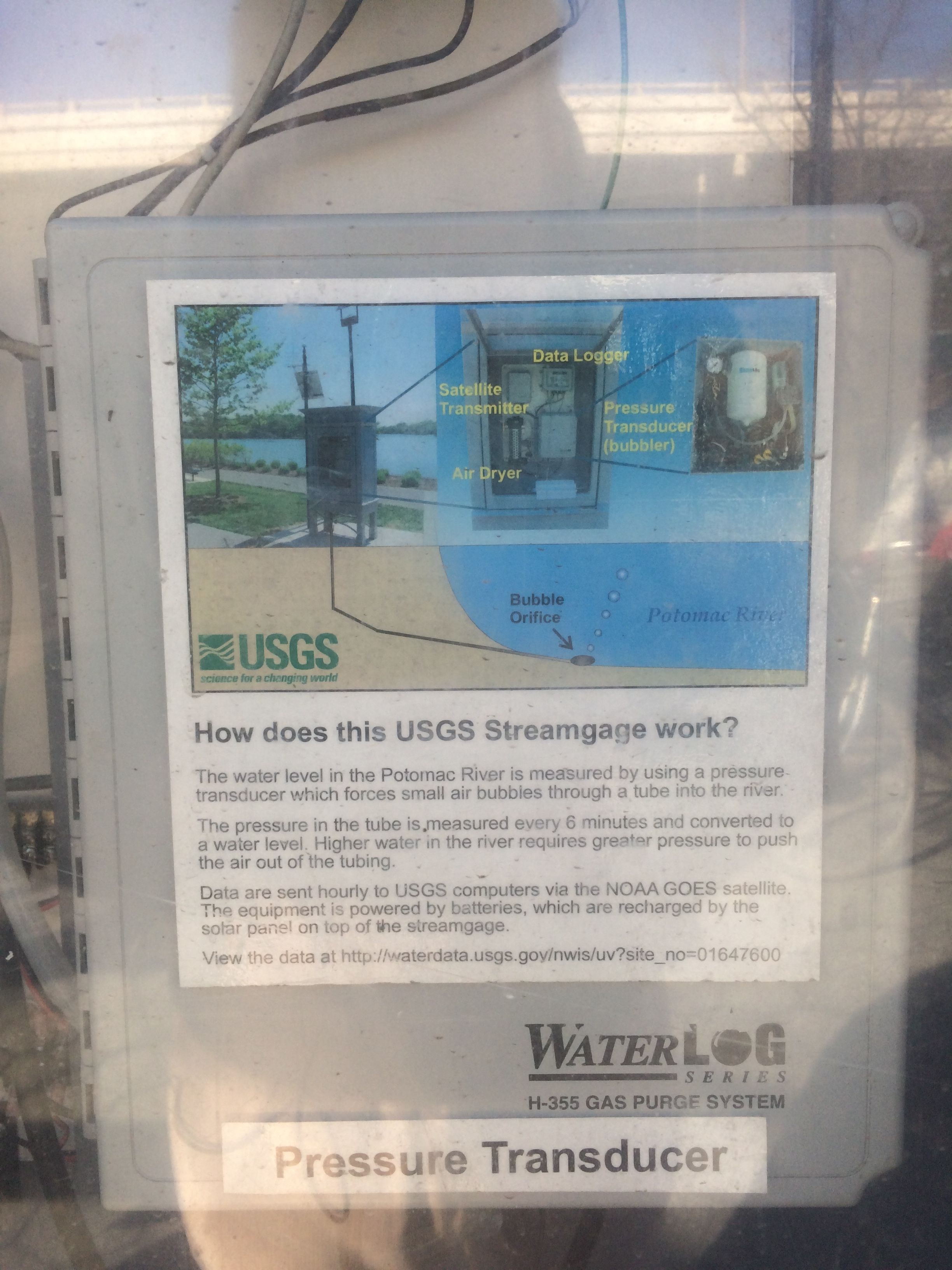
Signage on the USGS Streamgage | Additional Description:
How does this USGS Streamgage work?
The water level in the Potomac River is measured by using a pressure transducer which forces small air bubbles through a tube into the river.
The pressure in the tube is measured every 6 minutes and converted to a water level. Higher water in the river requires greater pressure to push the air out of the tubing.
Data are sent hourly to USGS computers via the NOAA GOES satellite. The equipment is powered by batteries, which are recharged by the solar panel on top of the streamgage.
View the data at http://waterdata.usgs.gov/nwis/uv?site_no=01647600
Submitted: January 27, 2018, by Devry Becker Jones of Washington, District of Columbia.
Database Locator Identification Number: p414672
File Size: 1.747 Megabytes
To see the metadata that may be embedded in this photo, sign in and then return to this page.