Photograph as originally submitted to
this page in the Historical Marker Database
www.HMdb.org.
Click on photo to resize in browser. Scroll down to see metadata.
Photographer: J. Makali Bruton
Taken: December 9, 2017
Caption:
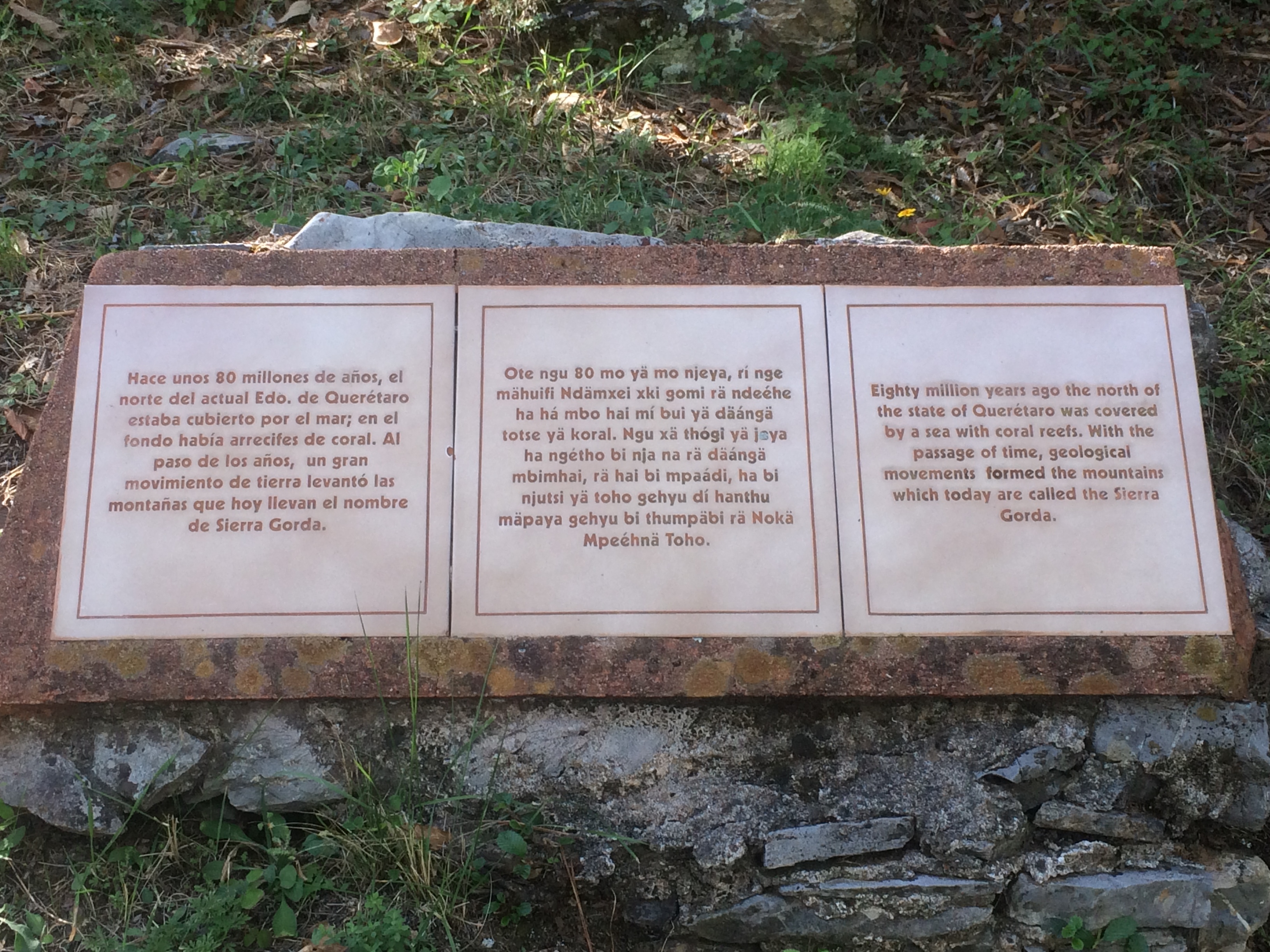
An additional marker on the Formation of the Sierra Gorda | Additional Description:
Formación de la Sierra Gorda
Hace unos 80 millones de años, el norte del actual Edo. de Querétaro estaba cubierto por el mar; en el fondo había arrecifes de coral. Al paso de los años, un gran movimiento de tierra levantó las montañas que hoy llevan el nombre de Sierra Gorda.
Hñähñú:
Formación de la Sierra Gorda
Ote ngu 80 mo yä mo njeya, rí nge mähuifi Ndämxei xki gomi rä ndeéhe ha há mbo hai mí bui yä däángä totse yä koral. Ngu xä thógi yä jeya ha negétho bi nja na rä däángä mbimhai, rä hai bi mpaádi, ha bi njutsi yä toho gehyu dí hanthu mäpaya gehyu bi thumpäbi rä Nokä Mpeéhnä Toho.
English:
Formation of the Sierra Gorda
Eighty million years ago the north of the state of Querétaro was covered by a sea with coral reefs. With the passage of time, geological movements formed the mountains which today are called the Sierra Gorda.
Submitted: February 1, 2018, by J. Makali Bruton of Accra, Ghana.
Database Locator Identification Number: p415158
File Size: 2.337 Megabytes
To see the metadata that may be embedded in this photo, sign in and then return to this page.