Photograph as originally submitted to
this page in the Historical Marker Database
www.HMdb.org.
Click on photo to resize in browser. Scroll down to see metadata.
Photographer: Barry Swackhamer
Taken: September 23, 2017
Caption:
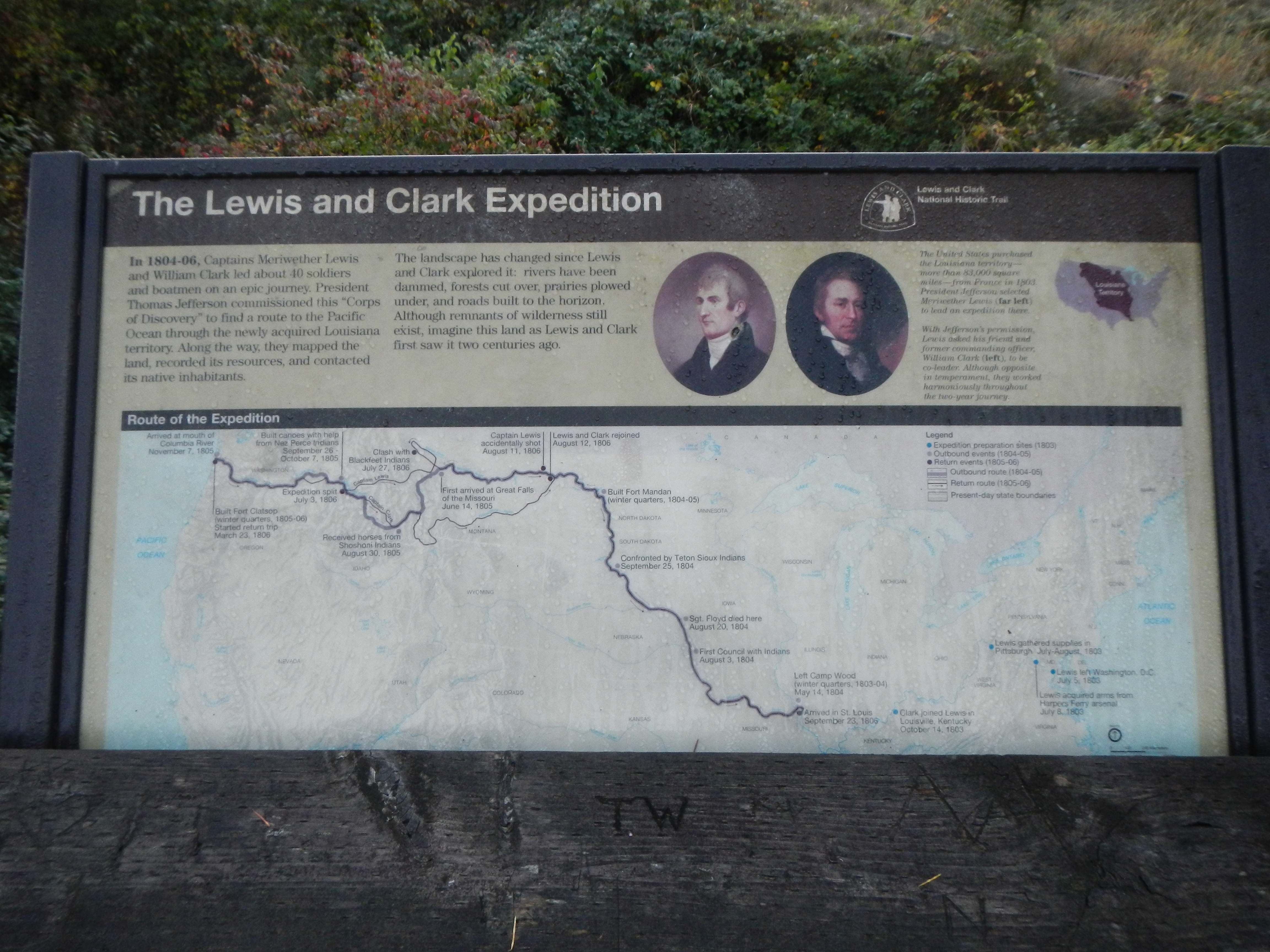
The Lewis and Clark Expedition Marker | Additional Description: Captions: (upper right) The United States purchased the Louisiana territory -- more that 83,000 square miles -- from France in 1803. President Jefferson selected Meriwether Lewis (far left) to lead an expedition there.
With Jefferson's permission Lewis asked his friend and former commanding officer William Clark (left) to be co-leader. Although opposite in temperament, the worked harmoniously throughout the two-year journey.; (map, across the bottom) Route of the Expedition (with annotations) (Click on image to enlarge the map.)
Submitted: February 2, 2018, by Barry Swackhamer of Brentwood, California.
Database Locator Identification Number: p415208
File Size: 3.681 Megabytes
To see the metadata that may be embedded in this photo, sign in and then return to this page.