Photograph as originally submitted to
this page in the Historical Marker Database
www.HMdb.org.
Click on photo to resize in browser. Scroll down to see metadata.
Photographer: Barry Swackhamer
Taken: September 22, 2017
Caption:
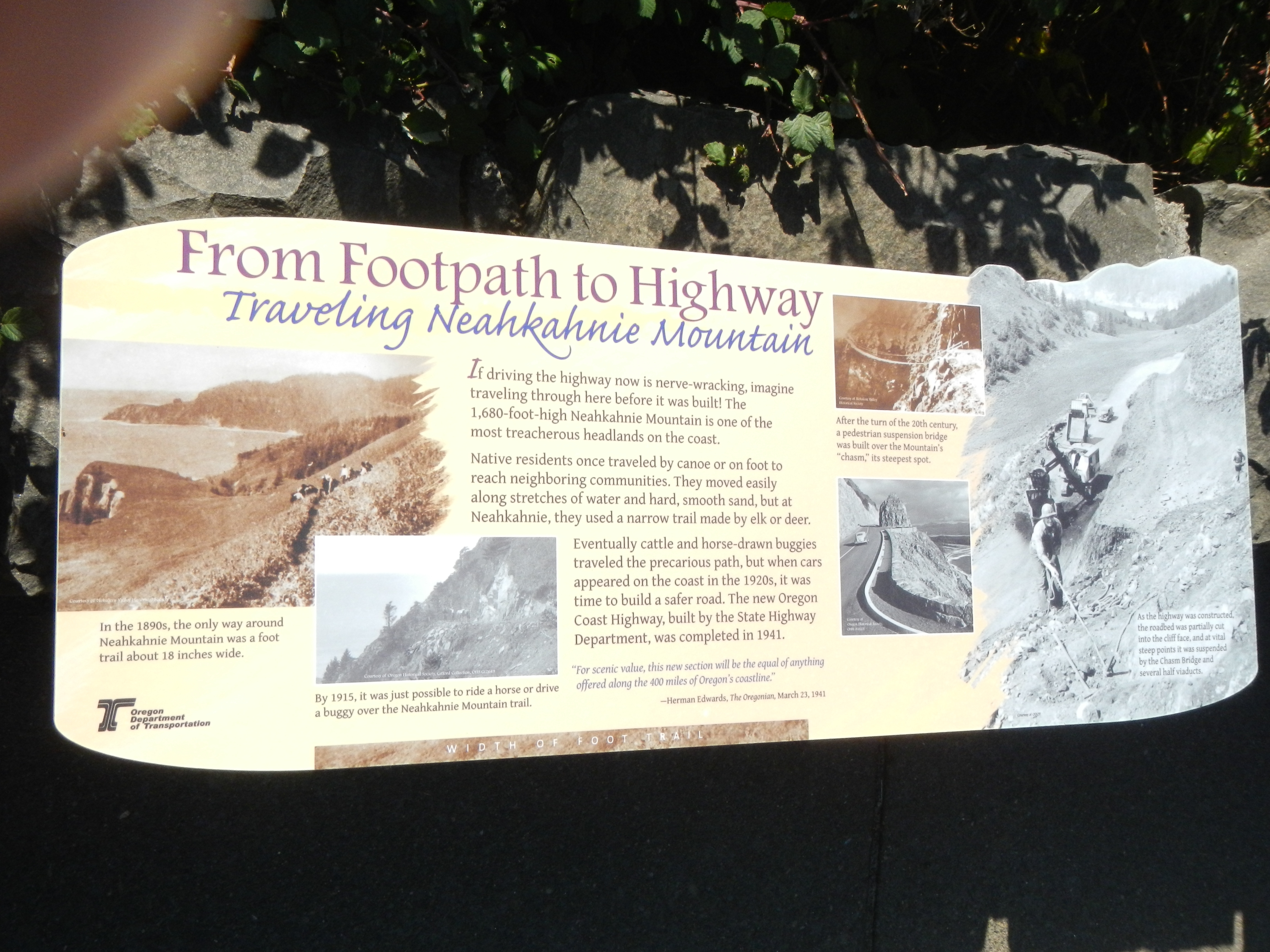
From Footpath to Highway Marker | Additional Description: Captions: (left) In the 1890s, the only way around Neahkahnie Mountain was a foot trail about 18 inches wide.; (bottom left) By 1915, it was just possible to ride a horse or drive a buggy over the Neahkahnie Mountain trail. (upper center right) After the turn of the 20th century, a pedestrian suspension bridge was built over the Mountain's "chasm,: its steepest spot.; (bottom right) As the highway was constructed, the roadbed was partially cut into the cliff face, and at vital steep points it was suspended by the Chasm Bridge and several half viaducts.
Submitted: February 4, 2018, by Barry Swackhamer of Brentwood, California.
Database Locator Identification Number: p415651
File Size: 3.621 Megabytes
To see the metadata that may be embedded in this photo, sign in and then return to this page.