Photograph as originally submitted to
this page in the Historical Marker Database
www.HMdb.org.
Click on photo to resize in browser. Scroll down to see metadata.
Photographer: Cosmos Mariner
Taken: July 5, 2017
Caption:
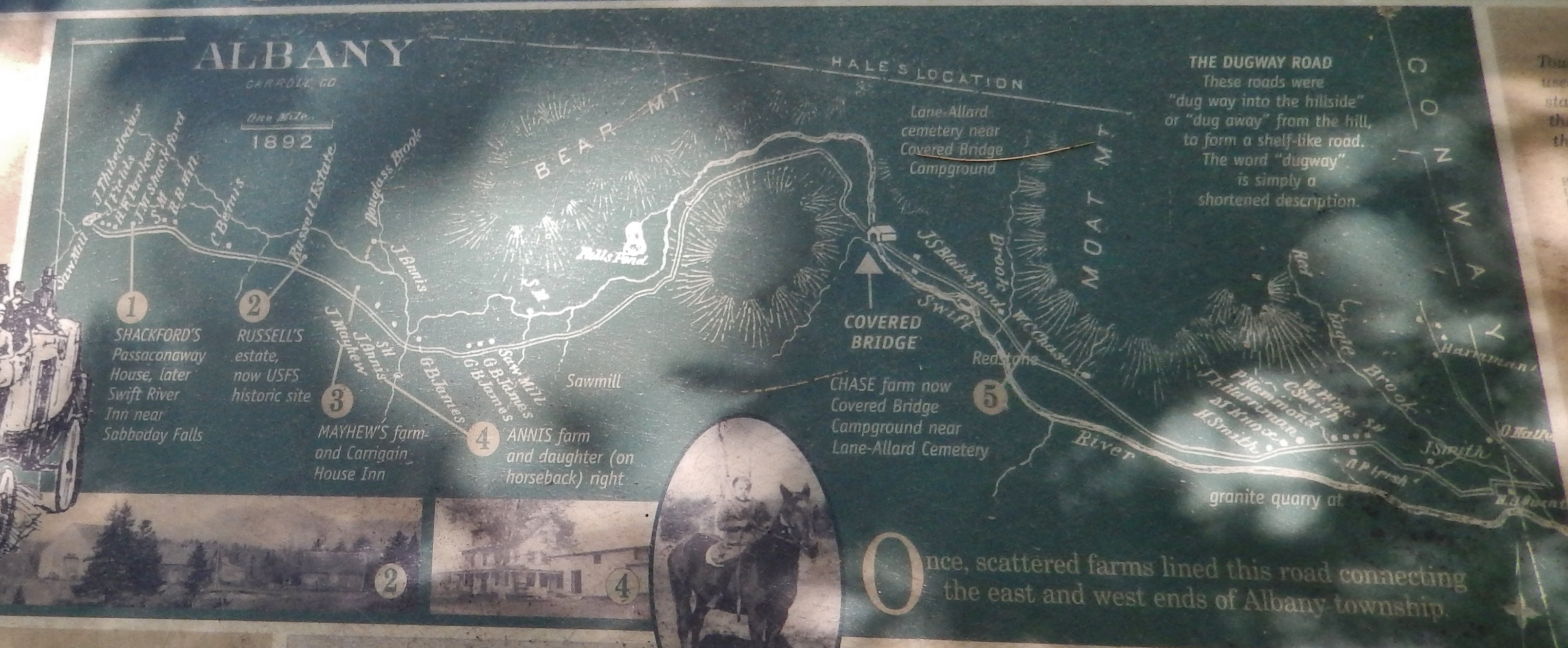
Marker detail: Albany map | Additional Description: Once, scattered farms linked this road connecting the east and west ends of Albany township.
Submitted: April 11, 2018, by Cosmos Mariner of Cape Canaveral, Florida.
Database Locator Identification Number: p422772
File Size: 1.394 Megabytes
To see the metadata that may be embedded in this photo, sign in and then return to this page.