Photograph as originally submitted to
this page in the Historical Marker Database
www.HMdb.org.
Click on photo to resize in browser. Scroll down to see metadata.
Photographer: Internet Archive
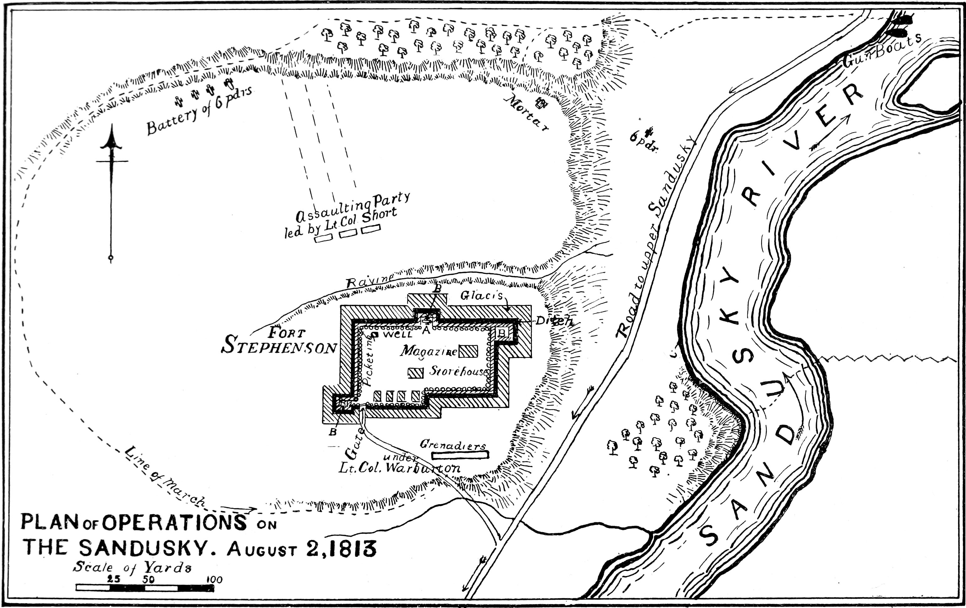
Caption:
Plan of Operations
The Sandusky
August 2, 1813 | Additional Description: This map of Fort Stephenson and the Sandusky River August 2, 1813 appeared in
The War of 1812 by John Richardson and Alexander Clark Casselman 1902.
Submitted: April 23, 2018, by Allen C. Browne of Silver Spring, Maryland.
Database Locator Identification Number: p424549
File Size: 0.751 Megabytes
To see the metadata that may be embedded in this photo, sign in and then return to this page.