Photograph as originally submitted to
this page in the Historical Marker Database
www.HMdb.org.
Click on photo to resize in browser. Scroll down to see metadata.
Caption:
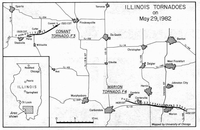
Storm Path (from May 1982 Storm Data report compiled by the NOAA National Weather Service) | Additional Description: Two major tornadoes occurred in southern Illinois on May 29th. The first, an F3, almost completely destroyed the small rural community of Conant. The second tornado carved a swath of F4 destruction through the north side of Marion, leaving 10 dead and 181 injured. The tornadoes paths, shown here F scale indicated where possible, were mapped from a Cessna 182 on June 1st by Duane Stiegler, University of Chicago.
Submitted: July 2, 2018, by Cosmos Mariner of Cape Canaveral, Florida.
Database Locator Identification Number: p433348
File Size: 6.994 Megabytes
To see the metadata that may be embedded in this photo, sign in and then return to this page.