Photograph as originally submitted to
this page in the Historical Marker Database
www.HMdb.org.
Click on photo to resize in browser. Scroll down to see metadata.
Photographer: Photo courtesy of the Los Angeles Public Library
Taken: Circa 1914
Caption:
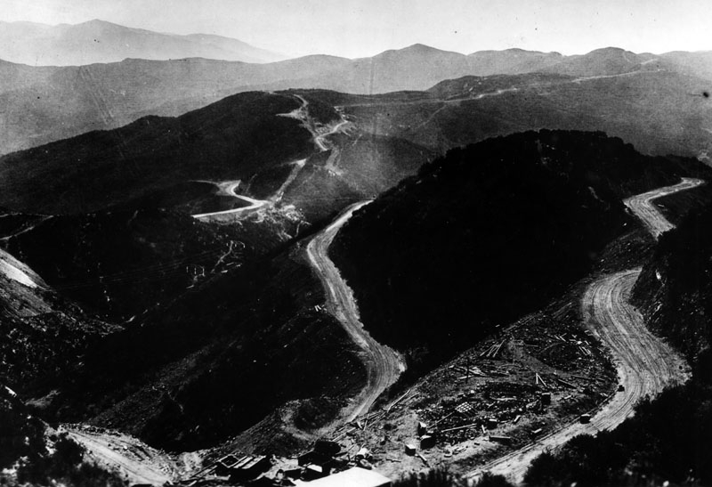
Original Ridge Route | Additional Description: "In this overview of the hills in the northern portion of Los Angeles County can be seen the building and carving out of the original Ridge Route. It was built between 1913 and 1915. The road ran from Castaic to Gorman and opened a path to the San Joaquin Valley via Tejon Pass on the northern end. It was replaced in 1933 by an Alternate Ridge Route which was shorter, and even later by Interstate 5 (Golden State Freeway). " - Los Angeles Public Library
Submitted: July 3, 2018.
Database Locator Identification Number: p433527
File Size: 0.107 Megabytes
To see the metadata that may be embedded in this photo, sign in and then return to this page.