Photograph as originally submitted to
this page in the Historical Marker Database
www.HMdb.org.
Click on photo to resize in browser. Scroll down to see metadata.
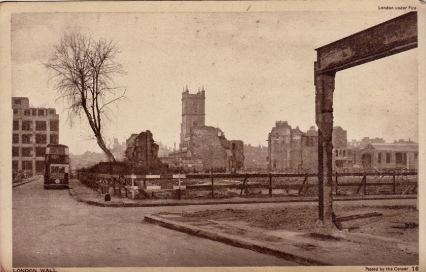
Photographer: Postcard published by Photochrome Co., Ltd., Royal Tunbridge Wells
Taken: Circa 1941
Caption:
Roman Wall | Additional Description: Looking west, the same section of Roman Wall that forms the south side of Salters Garden is visible here (right side of the tree). St. Giles Cripplegate is the church in the background (roughly 80-90 meters away), while the area that would be part of Salters Garden is part of the rubble-less ruins on the right.
Submitted: July 11, 2018, by Andrew Ruppenstein of Lamorinda, California.
Database Locator Identification Number: p434642
File Size: 0.181 Megabytes
To see the metadata that may be embedded in this photo, sign in and then return to this page.