Photograph as originally submitted to
this page in the Historical Marker Database
www.HMdb.org.
Click on photo to resize in browser. Scroll down to see metadata.
Photographer: William Fischer, Jr.
Taken: October 31, 2008
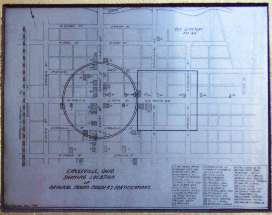
Caption:
Prehistoric Circular Earthworks on Map | Additional Description: Drawing included on marker.
Submitted: November 17, 2008, by William Fischer, Jr. of Scranton, Pennsylvania.
Database Locator Identification Number: p43899
File Size: 0.138 Megabytes
To see the metadata that may be embedded in this photo, sign in and then return to this page.