Photograph as originally submitted to
this page in the Historical Marker Database
www.HMdb.org.
Click on photo to resize in browser. Scroll down to see metadata.
Photographer: J. J. Prats
Taken: August 16, 2018
Caption:
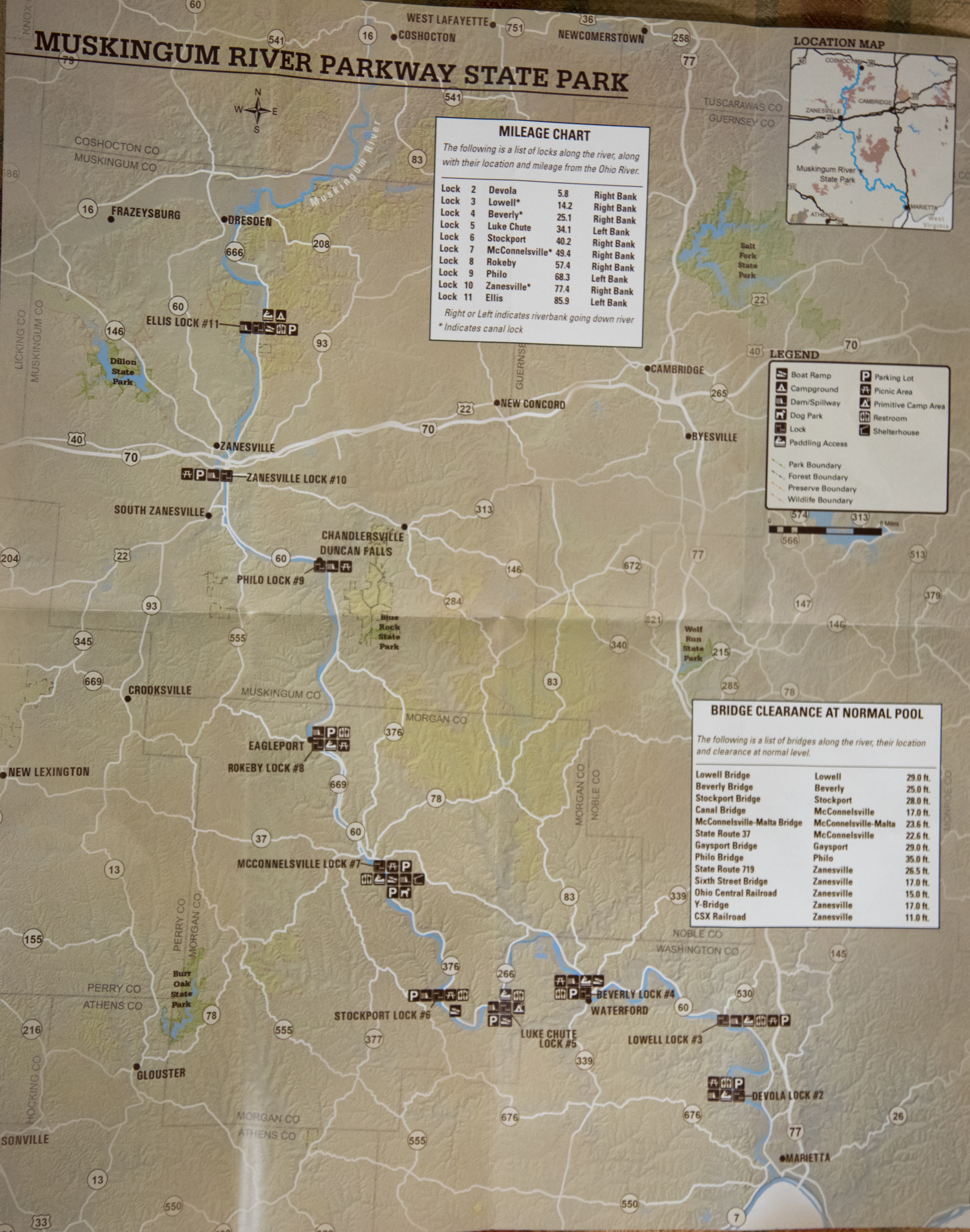
Muskingum River Parkway Map | Additional Description: This map is the centerfold of an illustrated one-sheet brochure available at all locks in the park. It is published by the Ohio Department of Natural Resources Division of Parks and Watercraft. Click on image to zoom in.
Submitted: August 16, 2018, by J. J. Prats of Powell, Ohio.
Database Locator Identification Number: p440908
File Size: 11.842 Megabytes
To see the metadata that may be embedded in this photo, sign in and then return to this page.