Photograph as originally submitted to
this page in the Historical Marker Database
www.HMdb.org.
Click on photo to resize in browser. Scroll down to see metadata.
Photographer: Allen C. Browne
Taken: April 20, 2019
Caption:
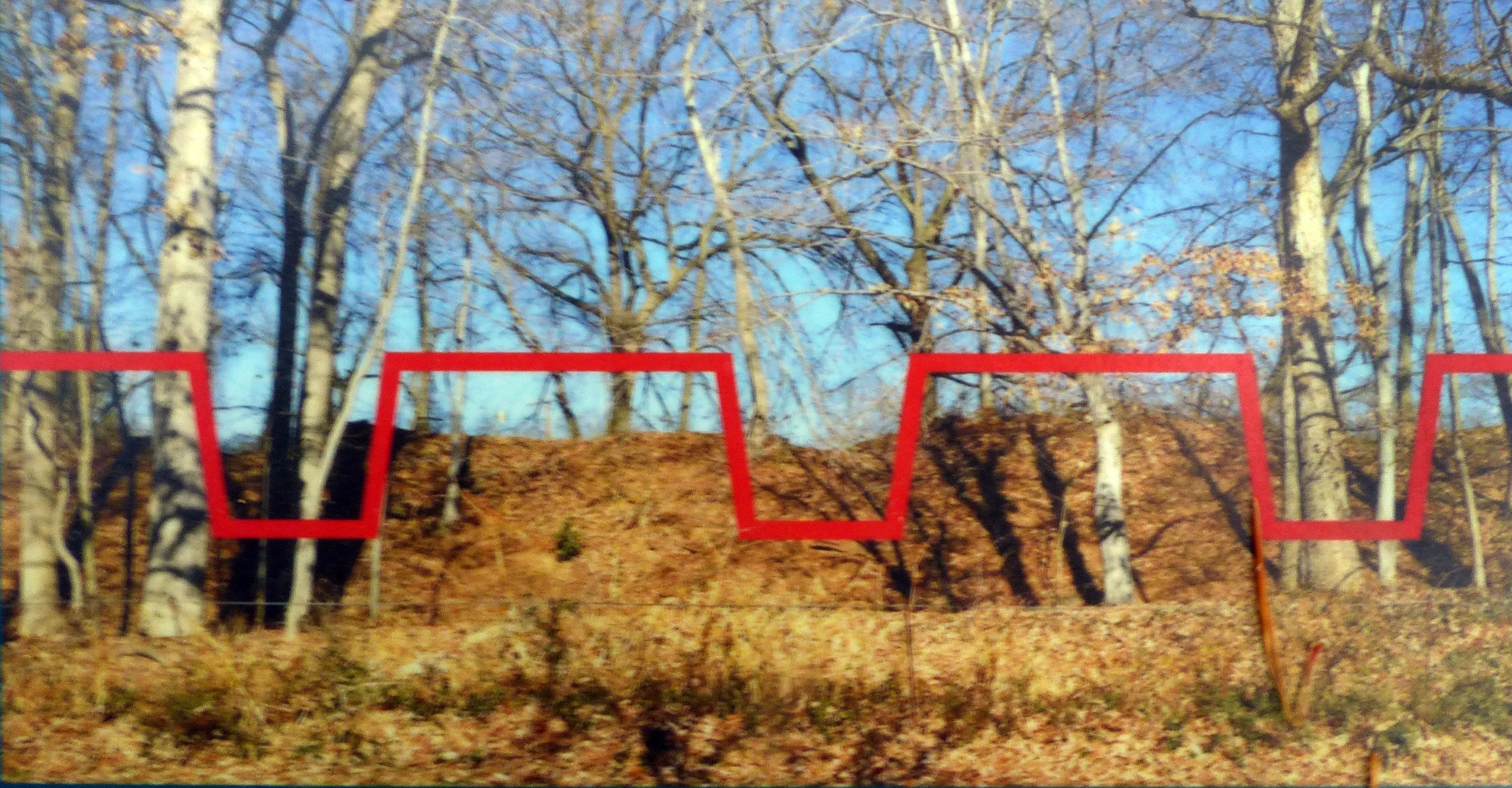
The Face of the Fort | Additional Description: The red line indicates the locations of the gun ports and the height of the rampart before it eroded. Trees now grow in what was a steeply sloped, 6-foot ditch.
Close-up of image on markerSubmitted: April 21, 2019, by Allen C. Browne of Silver Spring, Maryland.
Database Locator Identification Number: p471300
File Size: 1.582 Megabytes
To see the metadata that may be embedded in this photo, sign in and then return to this page.