Photograph as originally submitted to
this page in the Historical Marker Database
www.HMdb.org.
Click on photo to resize in browser. Scroll down to see metadata.
Photographer: Craig Swain
Taken: November 22, 2008
Caption:
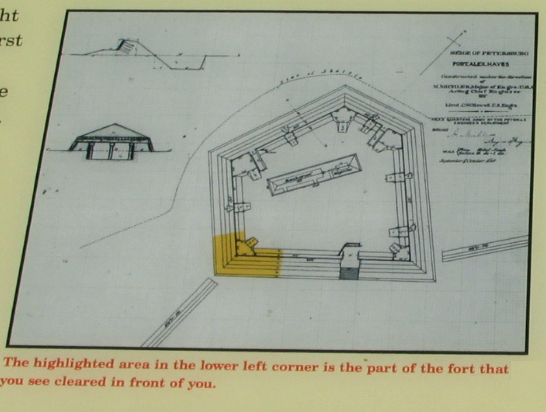
Close up of the Fort Plan | Additional Description: Note the highlighted portion which indicates the visible portion of the fort's earthworks.
Submitted: December 24, 2008, by Craig Swain of Leesburg, Virginia.
Database Locator Identification Number: p47653
File Size: 0.242 Megabytes
To see the metadata that may be embedded in this photo, sign in and then return to this page.