Photograph as originally submitted to
this page in the Historical Marker Database
www.HMdb.org.
Click on photo to resize in browser. Scroll down to see metadata.
Photographer: Bill Coughlin
Taken: April 23, 2007
Caption:
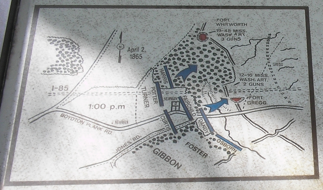
Battle Maps of Forts Whitworth and Gregg | Additional Description: This map, from another nearby Fort Whitworth marker, shows Union troop movements during the April 2, 1865 attack.
Submitted: December 30, 2008, by Bill Coughlin of Woodland Park, New Jersey.
Database Locator Identification Number: p48290
File Size: 2.183 Megabytes
To see the metadata that may be embedded in this photo, sign in and then return to this page.