Photograph as originally submitted to
this page in the Historical Marker Database
www.HMdb.org.
Click on photo to resize in browser. Scroll down to see metadata.
Photographer: Dale K. Benington
Taken: July 15, 2019
Caption:
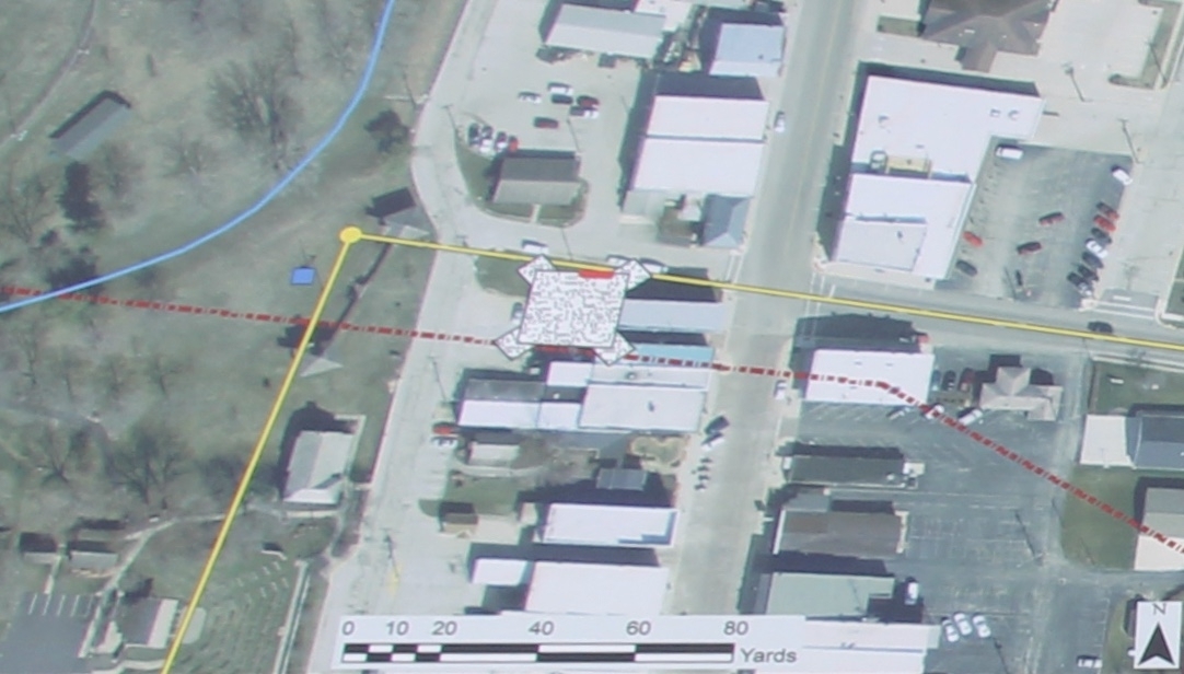
Locating the Fort Marker | Additional Description: Close-up view of the satellite photo map that is displayed on this marker. The caption reads as follows: Map drawn in GIS that shows the original sketch map from Wayne to Burbeck on the landscape with the 17 foot palisade wall discovered during the 2011 field school shown as the short red line. The yellow line and dot represents the Greenville Treaty Line which follows Boundary Street. The blue line signifies the old route of the Wabash River. The burgundy dashed line is the approximate location of St. Clair's Trace which marks the path that St. Clair originally took from Fort Jefferson. The blue square marks the location of the fort well discovered in 1936. GIS Map Credit: Applied Anthropology
Laboratories, Ball State University.
Submitted: August 4, 2019, by Dale K. Benington of Toledo, Ohio.
Database Locator Identification Number: p486522
File Size: 0.182 Megabytes
To see the metadata that may be embedded in this photo, sign in and then return to this page.