Photograph as originally submitted to
this page in the Historical Marker Database
www.HMdb.org.
Click on photo to resize in browser. Scroll down to see metadata.
Photographer: Mike Stroud
Caption:
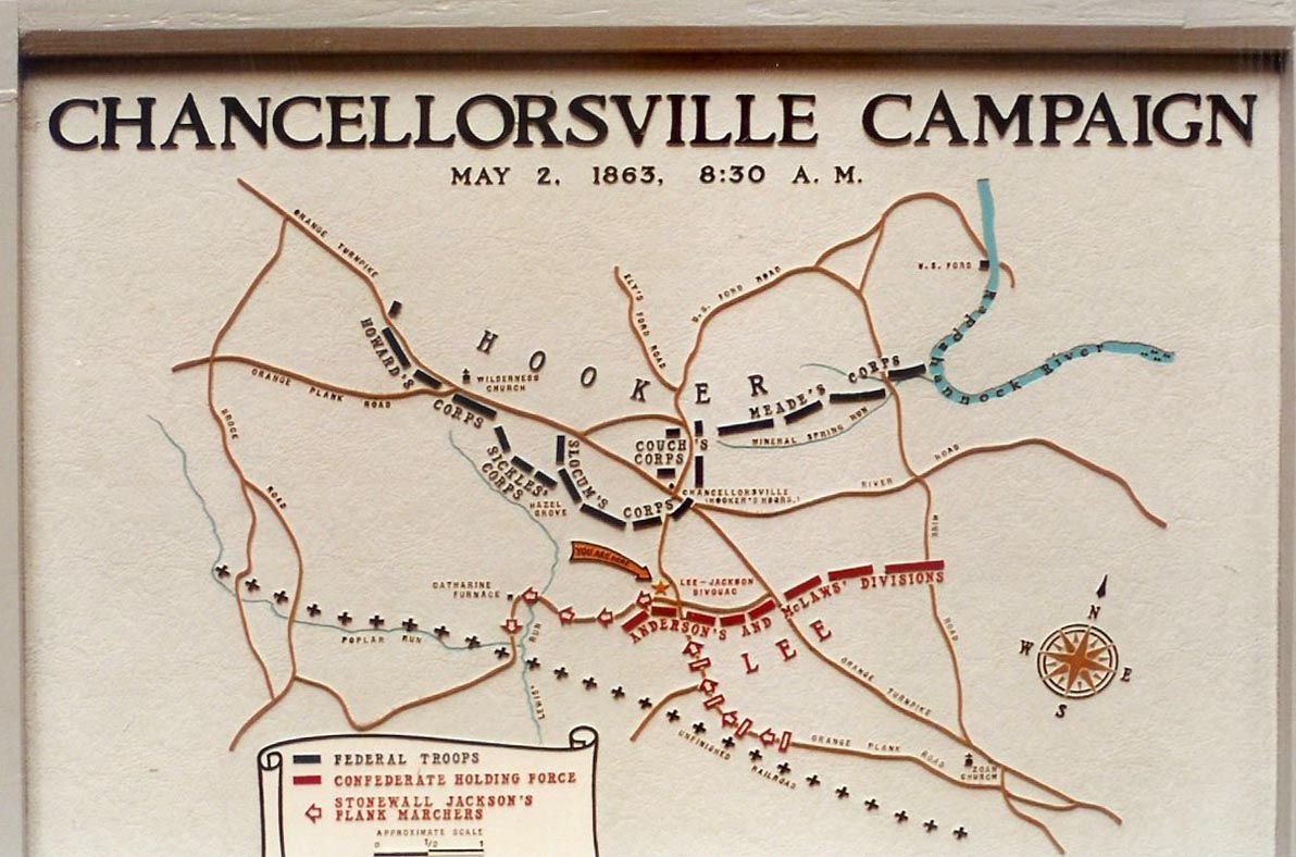
Chancellorsville Campaign Map | Additional Description: A relief map also stood next to this marker. It too was replaced by "wayside" interpretive markers. The legs of this marker and one other "Happel" are seen behind the close up photo of the main marker above.
Submitted: January 10, 2009, by Craig Swain of Leesburg, Virginia.
Database Locator Identification Number: p49432
File Size: 0.169 Megabytes
To see the metadata that may be embedded in this photo, sign in and then return to this page.