Photograph as originally submitted to
this page in the Historical Marker Database
www.HMdb.org.
Click on photo to resize in browser. Scroll down to see metadata.
Photographer: Steve Stoessel
Taken: August 27, 2019
Caption:
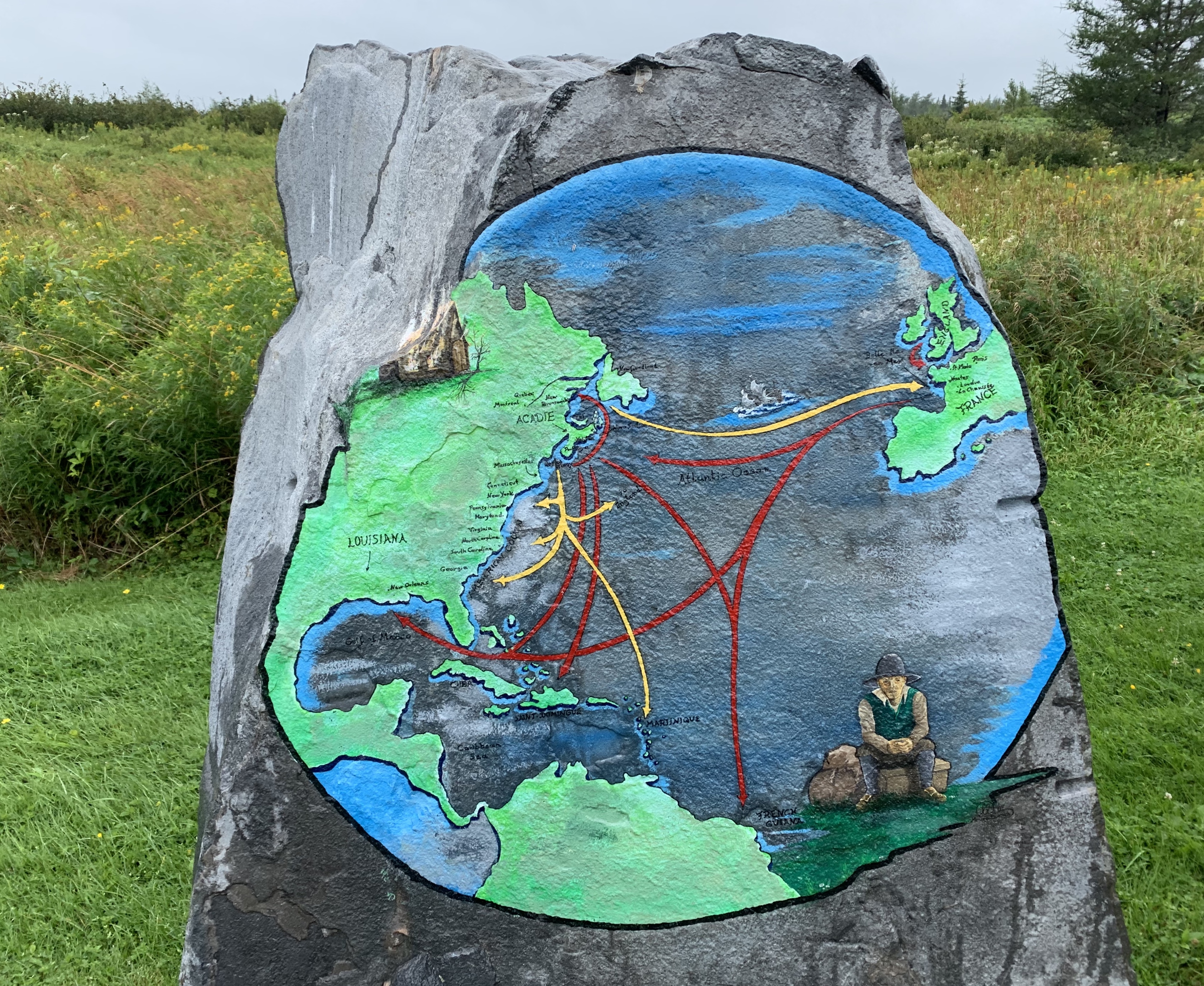
Map Showing the Routes and Methods of the Dispersal of the Acadians | Submitted: October 19, 2019, by Steve Stoessel of Niskayuna, New York.
Database Locator Identification Number: p498531
File Size: 0.547 Megabytes
To see the metadata that may be embedded in this photo, sign in and then return to this page.