Photograph as originally submitted to
this page in the Historical Marker Database
www.HMdb.org.
Click on photo to resize in browser. Scroll down to see metadata.
Caption:
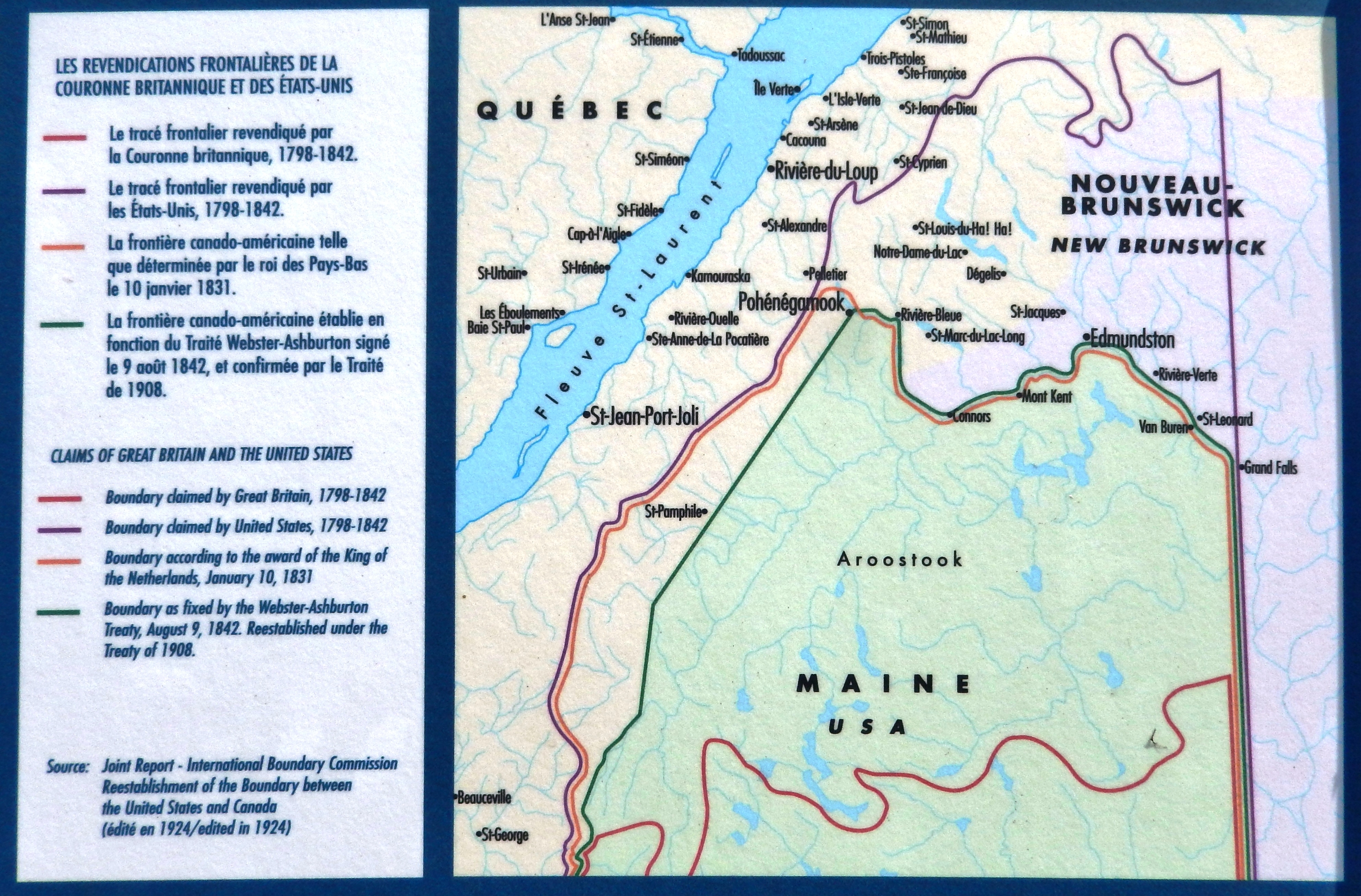
Marker detail: Canada-USA Border History | Additional Description:
Les Revendications Frontalières de la Couronne Britannique et des États-Unis• Le tracé frontalier revendiqué par la Couronne britannique, 1798-1842.
• Le tracé frontalier revendiqué par les États-Unis, 1798-1842.
• La frontière canodo-américaine telle que déterminée par le roi des Pays-Bas le 10 janvier 1831.
• La frontière canado-américaine établie en fonction du Traité Webster-Ashburton signé le 9 août 1842, et confirmée par le Traité de 1908.
Claims of Great Britain and the United States• Boundary claimed by Great Britain, 1798-1842
• Boundary claimed by United States, 1798-1842
• Boundary according to the award of the King of the Netherlands, January 10, 1831
• Boundary as fixed by the Webster-Ashburton Treaty, August 9, 1842. Reestablished under the Treaty of 1908.
Source: Joint Report - International Boundary Commission Reestablishment of the Boundary between the United States and Canada (édité en 1924/edited in 1924)
Submitted: November 18, 2019, by Cosmos Mariner of Cape Canaveral, Florida.
Database Locator Identification Number: p502881
File Size: 4.090 Megabytes
To see the metadata that may be embedded in this photo, sign in and then return to this page.