Photograph as originally submitted to
this page in the Historical Marker Database
www.HMdb.org.
Click on photo to resize in browser. Scroll down to see metadata.
Photographer: Barry Swackhamer
Taken: August 15, 2019
Caption:
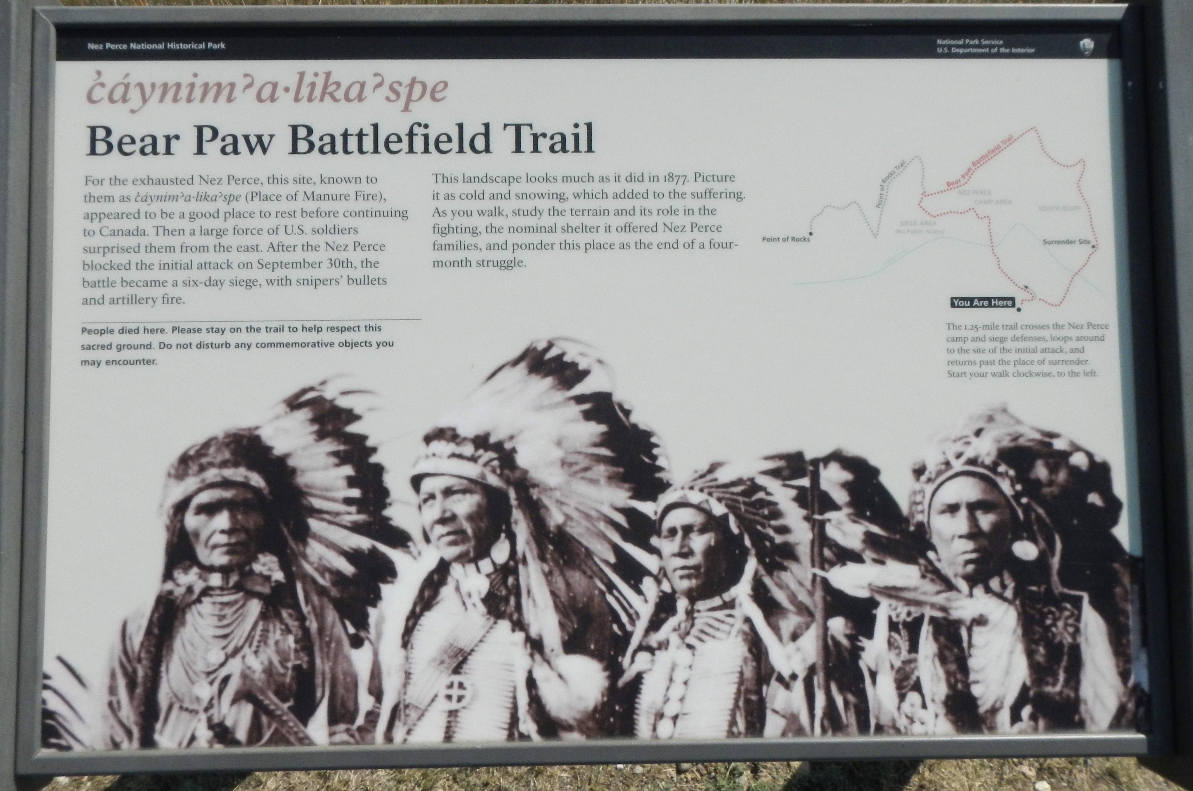
ćáynim?a•lika?spe Marker | Additional Description: Caption: (trail map at upper right) The 1.25-mile trail crosses the Nez Perce camp and siege defenses, loops around to the site of the initial attack, and returns pas the place of surrender. Start your walk clockwise, to the left.
Submitted: November 21, 2019, by Barry Swackhamer of Brentwood, California.
Database Locator Identification Number: p503165
File Size: 1.735 Megabytes
To see the metadata that may be embedded in this photo, sign in and then return to this page.