Photograph as originally submitted to
this page in the Historical Marker Database
www.HMdb.org.
Click on photo to resize in browser. Scroll down to see metadata.
Photographer: Richard Denney
Caption:
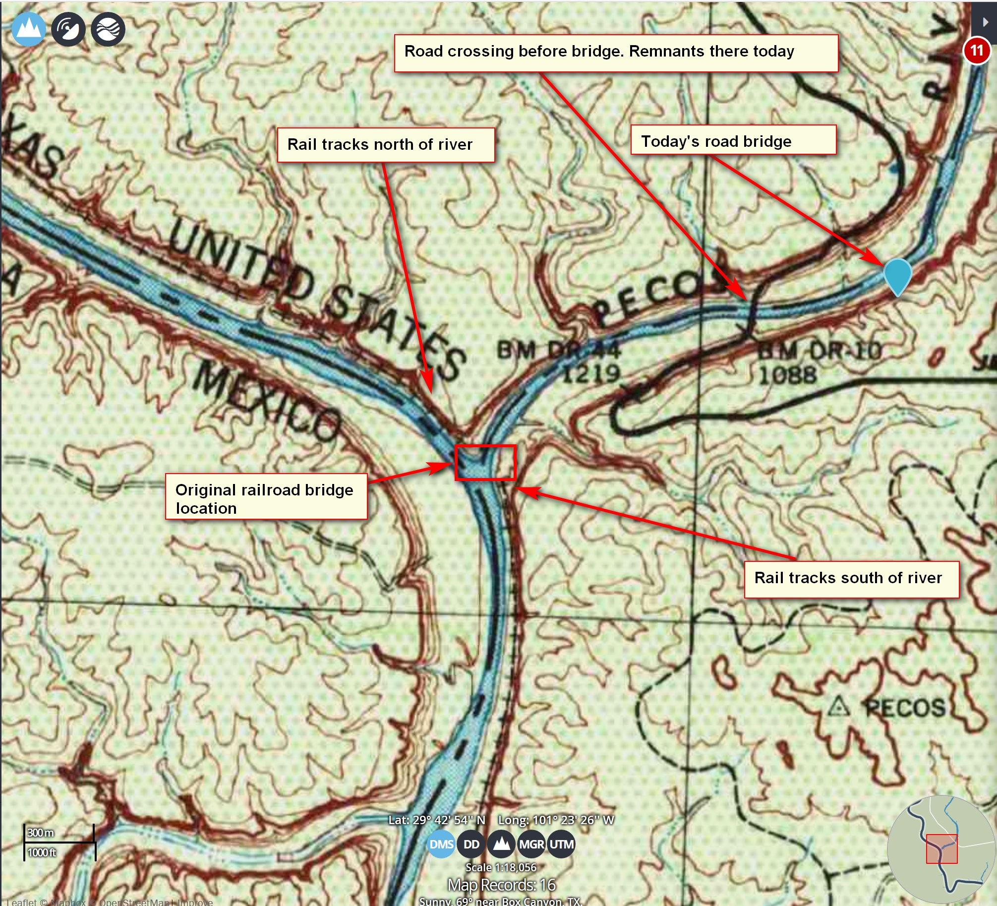
1944 USGS topo showing original Southern Pacific Railroad bridge crossing | Additional Description: This topo map is from the USGS 1944. You can see rail tracks north and south of river showing where the bridge would have been. Also, map showing how the highway crossed the Pecos before the current bridge. Remnants of that old road are still there, can be used to get down to river level for fishing, etc.
Submitted: December 6, 2019, by Richard Denney of Austin, Texas.
Database Locator Identification Number: p504583
File Size: 3.286 Megabytes
To see the metadata that may be embedded in this photo, sign in and then return to this page.