Photograph as originally submitted to
this page in the Historical Marker Database
www.HMdb.org.
Click on photo to resize in browser. Scroll down to see metadata.
Photographer: Larry Gertner
Taken: November 7, 2019
Caption:
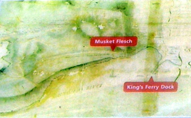
Inset | Additional Description: “This map of Stony Point highlights the King’s Ferry dock and nearby musket flesch, or fortification, used to protect the dock. The map was drawn by British Lieutenant William Marshall, 63rd Regiment of Foot, sometime between 1780 and 1783.”
Submitted: December 18, 2019, by Larry Gertner of New York, New York.
Database Locator Identification Number: p505496
File Size: 0.079 Megabytes
To see the metadata that may be embedded in this photo, sign in and then return to this page.