Photograph as originally submitted to
this page in the Historical Marker Database
www.HMdb.org.
Click on photo to resize in browser. Scroll down to see metadata.
Photographer: Douglass Halvorsen
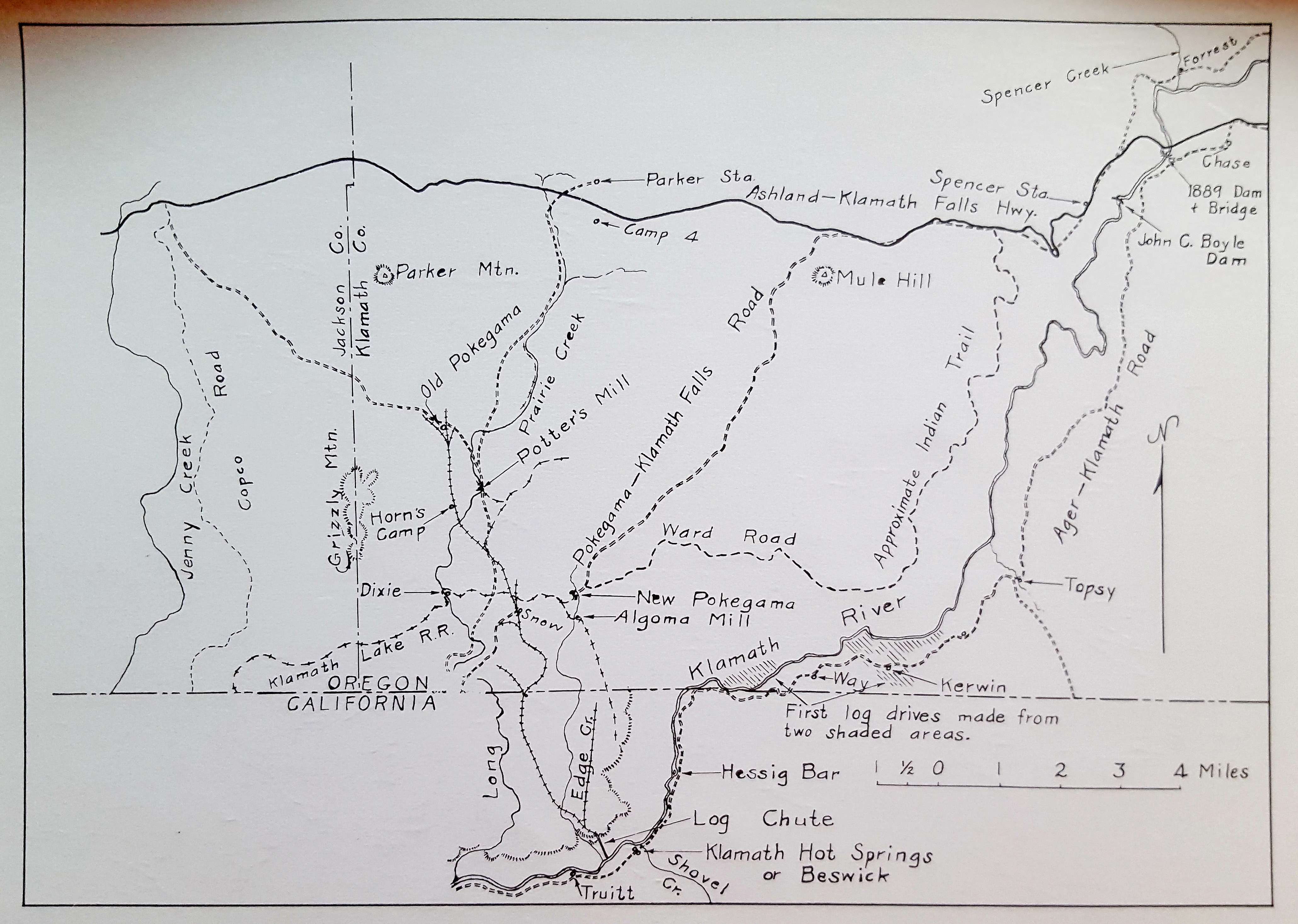
Caption:
Klamath Echoes map, 1966 | Additional Description: A hand drawn map showing the area between Klamath River and Highway 66 with former logging railroads, mills and camps.
Submitted: April 4, 2020, by Douglass Halvorsen of Klamath Falls, Oregon.
Database Locator Identification Number: p515617
File Size: 7.713 Megabytes
To see the metadata that may be embedded in this photo, sign in and then return to this page.