Photograph as originally submitted to
this page in the Historical Marker Database
www.HMdb.org.
Click on photo to resize in browser. Scroll down to see metadata.
Caption:
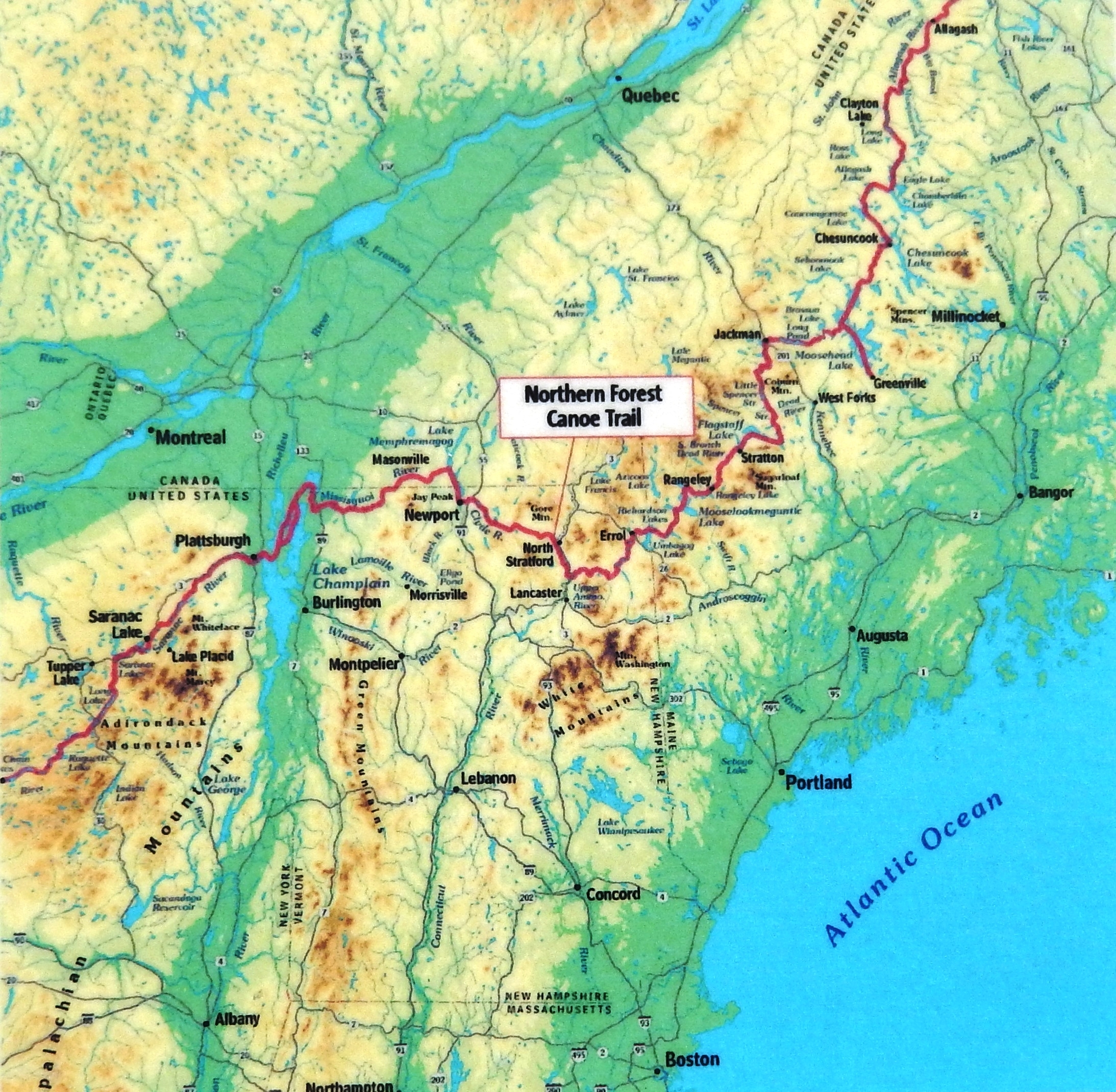
Marker detail: Waterways of the Northern Forest
(Northern Forest Canoe Trail Map) | Additional Description: The Northern Forest Canoe Trail traverses 22 rivers and streams, 56 lakes and ponds and over a dozen watersheds as it passes through an area known as the Northern Forest. In this boreal landscape, the rivers and forests have always been the center of ecology, culture and economics. Names like Missisquoi and Ammonoosuc recall the first people to ply the waters in birchbark canoes, hunting and trading along the same routes that eventually brought European explorers inland. Water power fueled growing communities and industries. Rivers carried logs from forest to mill for lumber to build the growing cities of the Northeast. City-dwellers followed waterways into the wilderness for rejuvenation and sport. Today, for both recreation and livelihood, rivers and forests continue to be central to life here, and the Trail flows like a common thread, weaving together the historical, cultural and natural stories of the region.
The Northern Forest today • 30 million acres: the largest area of intact forest in the eastern U.S.
• 1.5 million residents
• the headwaters of the major rivers of the northeastern U.S.: Hudson, Connecticut, Androscoggin, Kennebec, Penobscot, St. John
• reforested since the 1850s when it was the leading timber producer in the world
• more boat launches per capita than anywhere else in the northeastern U.S.!
Submitted: June 25, 2020, by Cosmos Mariner of Cape Canaveral, Florida.
Database Locator Identification Number: p527578
File Size: 2.226 Megabytes
To see the metadata that may be embedded in this photo, sign in and then return to this page.