Photograph as originally submitted to
this page in the Historical Marker Database
www.HMdb.org.
Click on photo to resize in browser. Scroll down to see metadata.
Photographer: Duane and Tracy Marsteller
Taken: July 3, 2020
Caption:
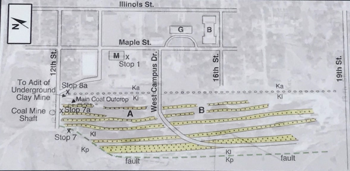
Stop 7a: White Ash Mine Marker Detail | Additional Description: Fig. 4: Sketch map of sandstone ridges in yellow and Clay Pits Fault in green. Map is overlaid over aerial photo from 1948.
Ka = Arapahoe • Kl = Laramie Formation • Kp = Pierre Shale
— Rubey Mine Area A between 12th Street and West Campus Drive was largely mined by surface methods
— Rubey Mine Area B was by underground mining with the entrance near 12th Street
Submitted: July 14, 2020, by Duane and Tracy Marsteller of Murfreesboro, Tennessee.
Database Locator Identification Number: p530015
File Size: 0.158 Megabytes
To see the metadata that may be embedded in this photo, sign in and then return to this page.