Photograph as originally submitted to
this page in the Historical Marker Database
www.HMdb.org.
Click on photo to resize in browser. Scroll down to see metadata.
Photographer: Duane and Tracy Marsteller
Taken: July 3, 2020
Caption:
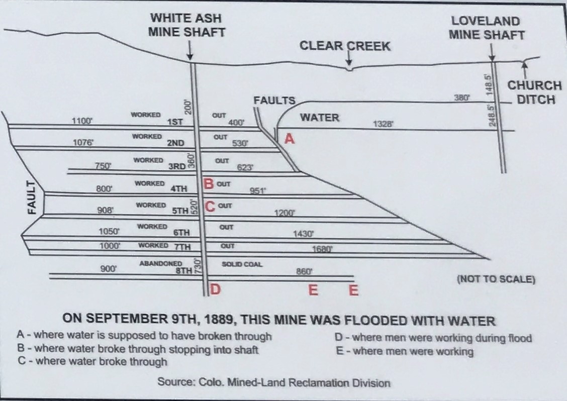
Stop 7a: White Ash Mine Marker Deatil | Additional Description: Fig. 6: Above is a south to north section diagram of the White Ash mine drawn along the coal seam occurring from 750 to 1076 feet south of 12th Street and from 400 to 1660 feet north of Clear Creek. Below is a technical description of the mine.
"A longitudinal cross-section of the Old White Ash mine at the date of abandonment shows the collar of the shaft to be 135 feet west of the main worked seam, and at the 600-foot level was still 39 feet to the west. Below this the strata became vertical with indication of an easterly turn, so that the shaft will nowhere cut the main seam. the seam is opened from the shaft by cross-cuts, levels being driven from these. The main coal seam 6 to 8 feet thick was mined to a depth of 730 feet. A second seam, 3 feet thick, lies from 10 to 20 feet west of that worked. This has been found to vary considerably in thickness, but has never fallen below workable limits."
(Emmons, S.F., Cross, W., and Eldridge, G.H., 1896, Geology of the Denver Basin, United States Geology Survey Monograph 27)
Submitted: July 15, 2020, by Duane and Tracy Marsteller of Murfreesboro, Tennessee.
Database Locator Identification Number: p530280
File Size: 0.188 Megabytes
To see the metadata that may be embedded in this photo, sign in and then return to this page.