Photograph as originally submitted to
this page in the Historical Marker Database
www.HMdb.org.
Click on photo to resize in browser. Scroll down to see metadata.
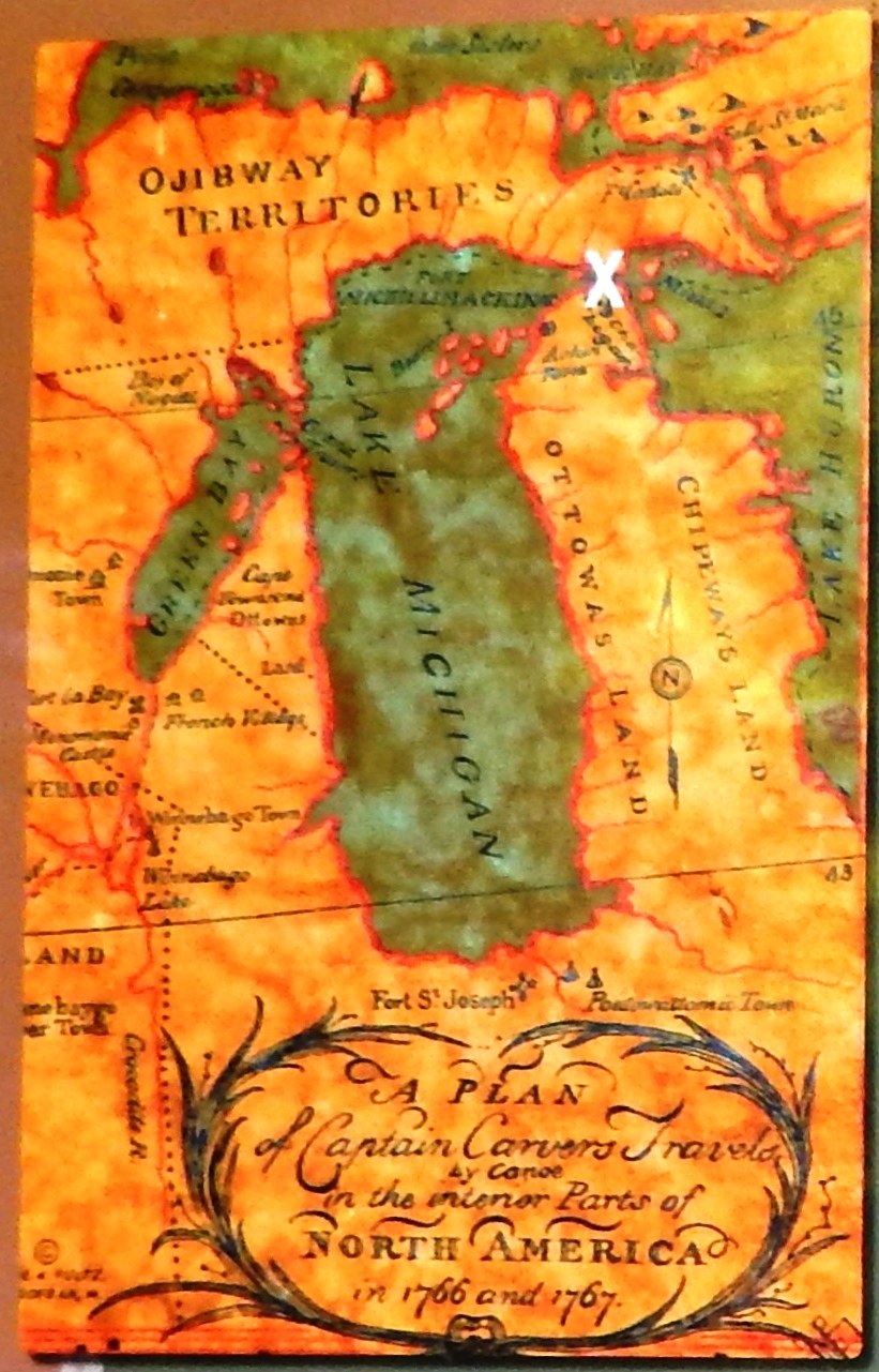
Caption:
Marker detail: Michigan in 1776 | Additional Description: This 1776 map shows the perception of Michigan during Nissowaquet's time. It demonstrates the lack of understanding of geography before cartography became more advanced. It’s also interesting to note the delineation of the three main named territories of the time: The Ottoways Land, Chippeways Land and Ojibway Territories. But that was about to change with the arrival of the French, and then the British.
Note: the white
X on the map denotes the approximate location of the Michilimackinac area.
Submitted: August 16, 2020, by Cosmos Mariner of Cape Canaveral, Florida.
Database Locator Identification Number: p535022
File Size: 0.487 Megabytes
To see the metadata that may be embedded in this photo, sign in and then return to this page.