Photograph as originally submitted to
this page in the Historical Marker Database
www.HMdb.org.
Click on photo to resize in browser. Scroll down to see metadata.
Photographer: Bernard Fisher
Taken: February 9, 2009
Caption:
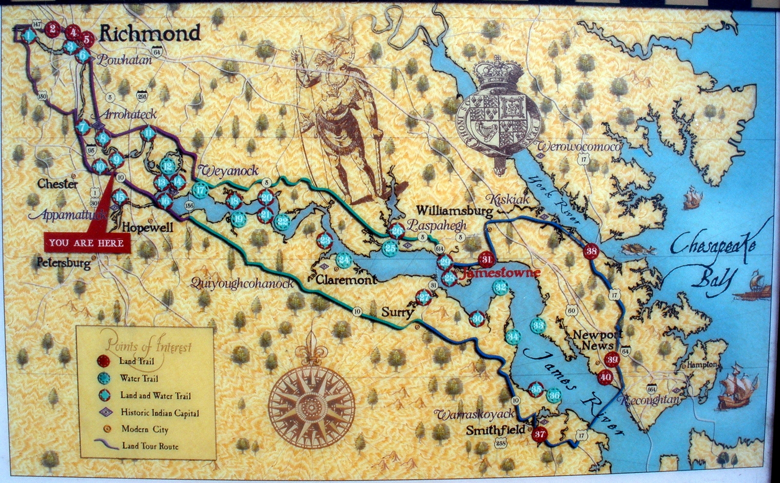
Map of Captain John Smith's Trail. | Submitted: February 22, 2009, by Bernard Fisher of Richmond, Virginia.
Database Locator Identification Number: p53682
File Size: 1.254 Megabytes
To see the metadata that may be embedded in this photo, sign in and then return to this page.