Photograph as originally submitted to
this page in the Historical Marker Database
www.HMdb.org.
Click on photo to resize in browser. Scroll down to see metadata.
Photographer: Barry Swackhamer
Taken: August 7, 2020
Caption:
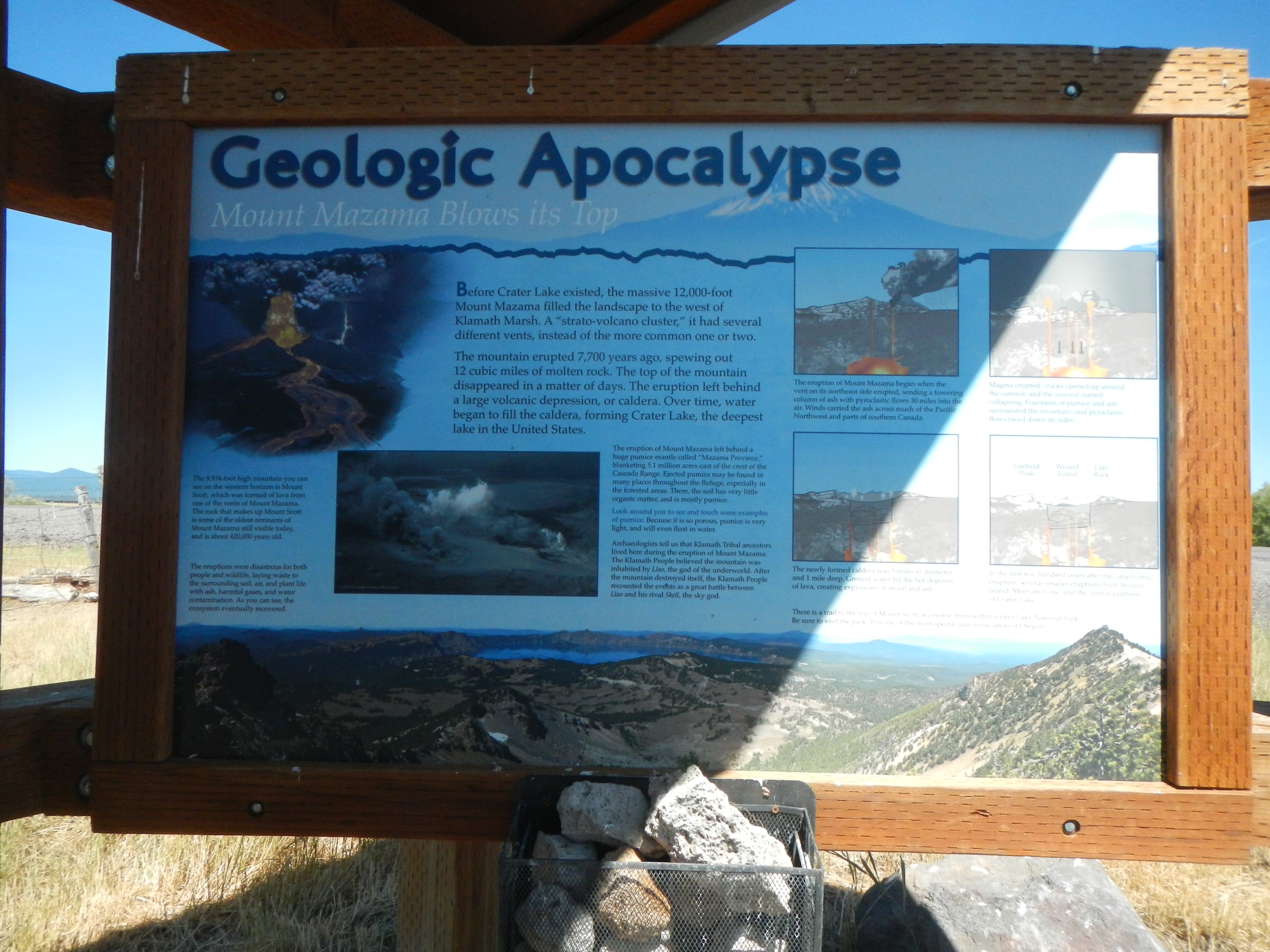
Geologic Apocalypse Marker | Additional Description: Captions: (
On the right are four panels that depict the collapse of Mount Mazama and the creation of Crater Lake.) The eruption of Mount Mazama began when the vent on the northeast side erupted, sending a towering column of ash with pyroclastic flows 30 miles into the air. Winds carried the ash across but of the Pacific Northwest and parts of southeastern Canada. -- Magma erupted, cracks opened up around the summit, and the summit started collapsing. Fountains of pumice and ash surrounded the mountain, and pyroclastic flows raced down its sides. -- The newly formed caldera was 5 miles in diameter and 1 mile deep. Ground water hit the hot deposits of lava, creating explosions of steam and ash. -- In the first few hundred years after the cataclysmic eruption, several smaller eruptions built Wizard Island, Merriam Cone and the central platform of Crater Lake.
Submitted: October 7, 2020, by Barry Swackhamer of Brentwood, California.
Database Locator Identification Number: p542346
File Size: 3.390 Megabytes
To see the metadata that may be embedded in this photo, sign in and then return to this page.