Photograph as originally submitted to
this page in the Historical Marker Database
www.HMdb.org.
Click on photo to resize in browser. Scroll down to see metadata.
Caption:
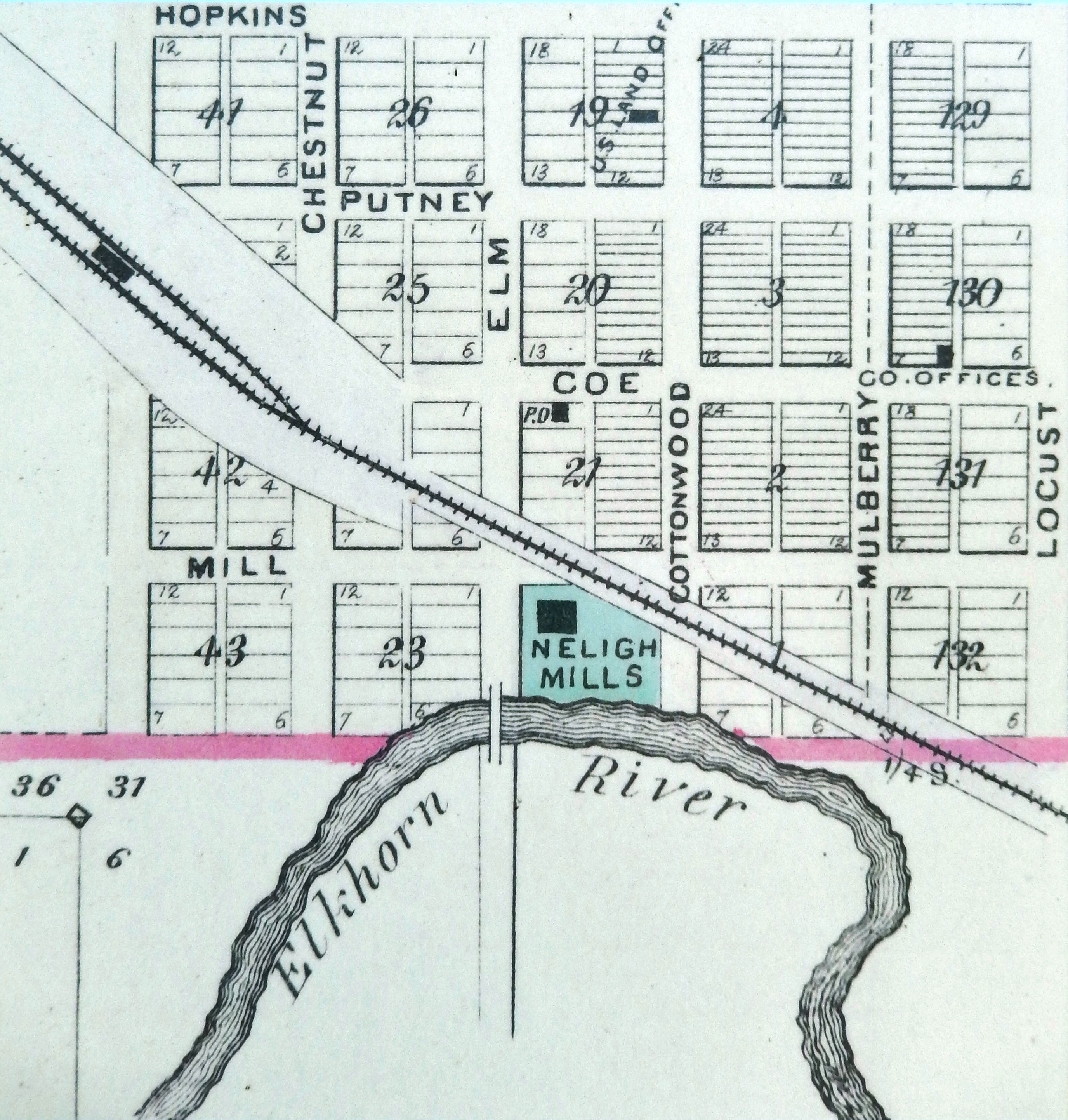
Marker detail: Early 1880s Plat Map | Additional Description: An early 1880s plat map showing Neligh Mill’s location on a high bank above a bend where water could easily be diverted.
Submitted: November 2, 2020, by Cosmos Mariner of Cape Canaveral, Florida.
Database Locator Identification Number: p547376
File Size: 3.194 Megabytes
To see the metadata that may be embedded in this photo, sign in and then return to this page.