Photograph as originally submitted to
this page in the Historical Marker Database
www.HMdb.org.
Click on photo to resize in browser. Scroll down to see metadata.
Photographer: Courtesy Historical Society of Dayton Valley
Caption:
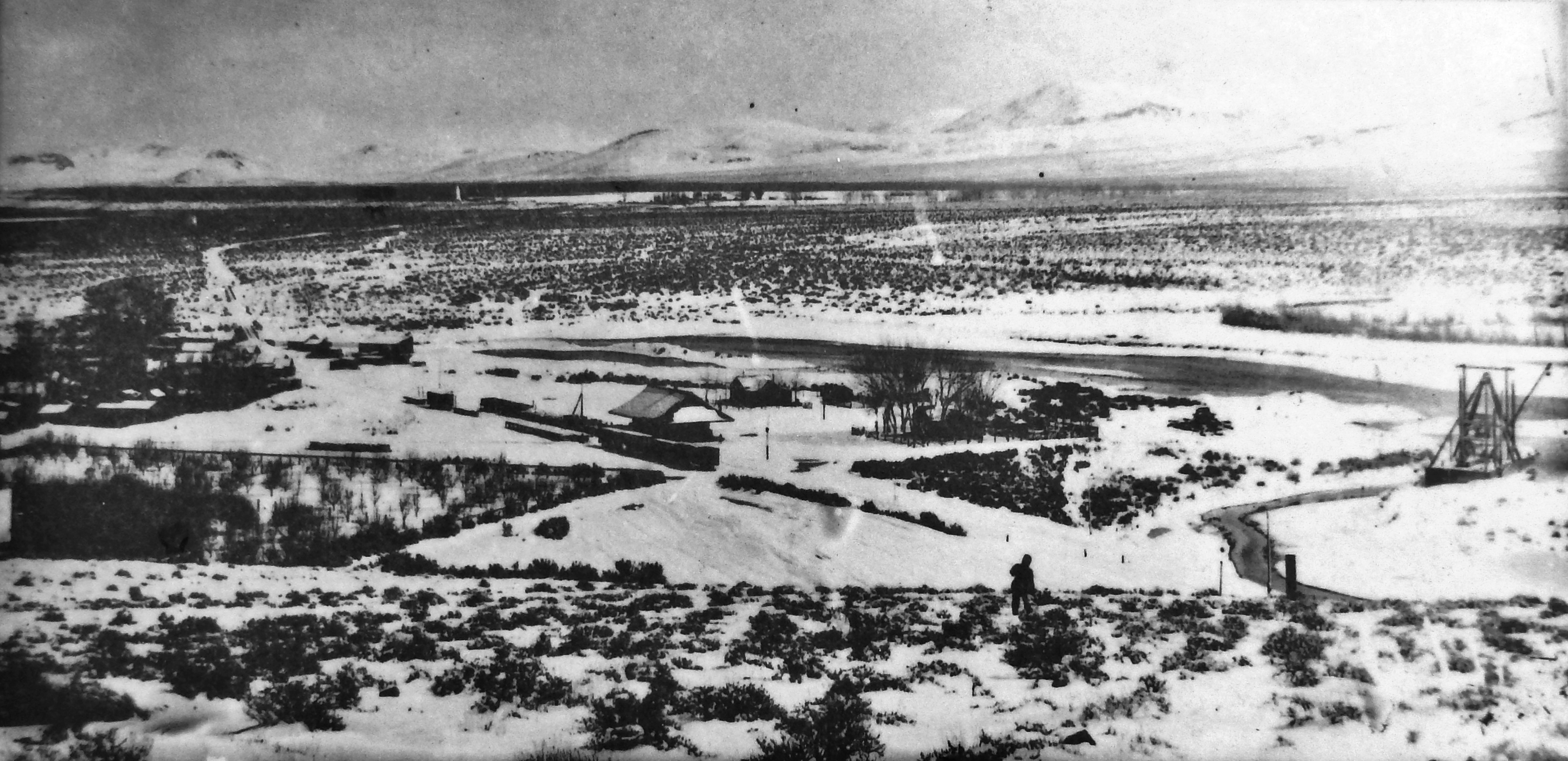
Marker detail: Eagle Eye's View of Dayton Valley, circa 1890 | Additional Description: This rare photograph, taken from a vantage point in the hills west of town, reveals how Dayton has changed from the days when it was a railroading, milling, mining, farming, and ranching settlement. At lower left is an apple orchard and, in the yard, a chicken house. To the right of the railroad station a floating dredge recovers gold and mercury from the riverbed. The Carson River flows in the center. The Pine Nut Range, to the southeast (where the mining town of Como grew and then faded), was the summer camp for the Paiutes. Each fall the Paiutes harvested the pine nut, their main food source.
Submitted: November 26, 2020, by Cosmos Mariner of Cape Canaveral, Florida.
Database Locator Identification Number: p552381
File Size: 2.579 Megabytes
To see the metadata that may be embedded in this photo, sign in and then return to this page.