Photograph as originally submitted to
this page in the Historical Marker Database
www.HMdb.org.
Click on photo to resize in browser. Scroll down to see metadata.
Photographer: Bureau of Land Management
Caption:
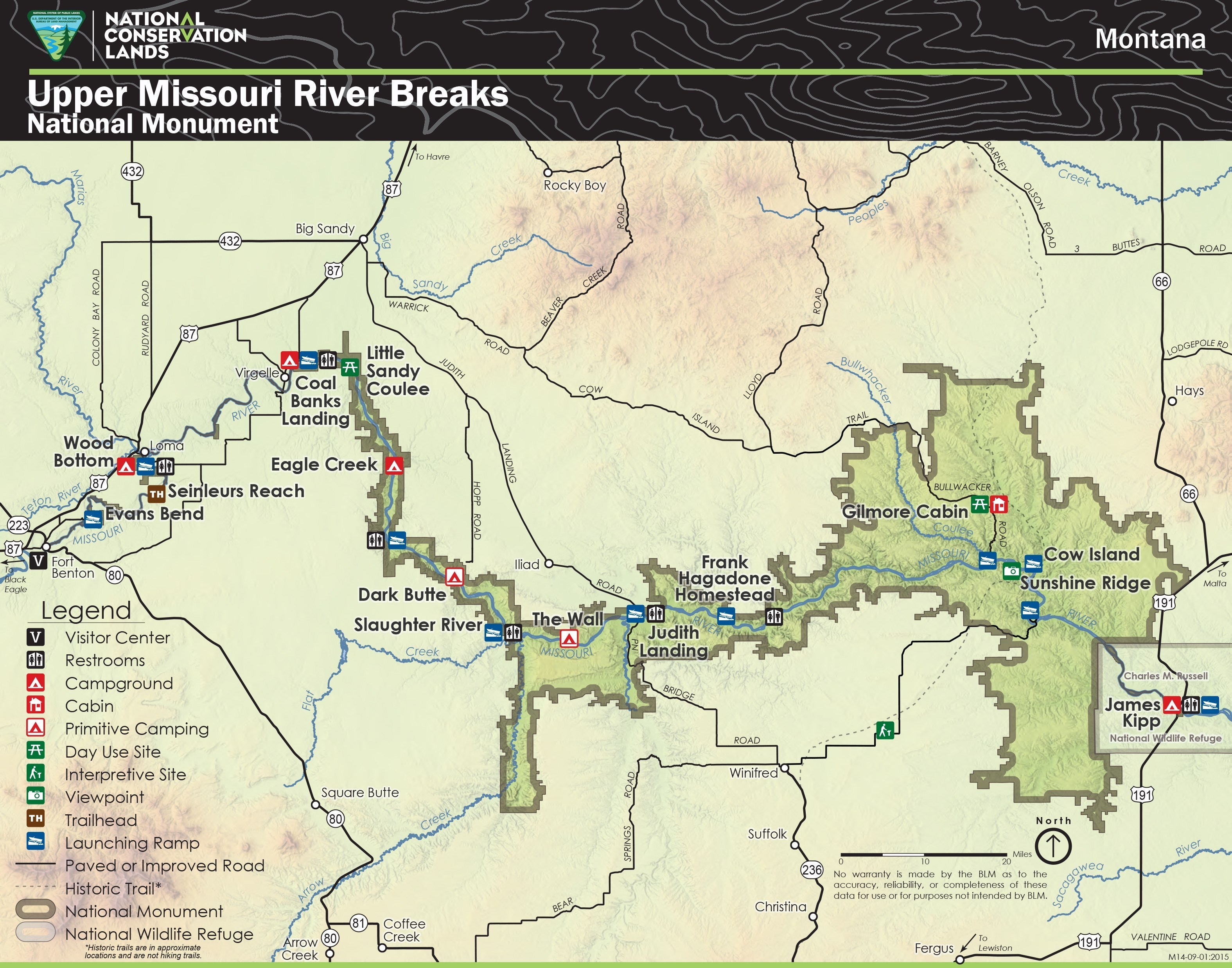
Map of the Upper Missouri Breaks National Monument | Submitted: December 5, 2020, by Barry Swackhamer of Brentwood, California.
Database Locator Identification Number: p554836
File Size: 1.376 Megabytes
To see the metadata that may be embedded in this photo, sign in and then return to this page.