Photograph as originally submitted to
this page in the Historical Marker Database
www.HMdb.org.
Click on photo to resize in browser. Scroll down to see metadata.
Photographer: Barry Swackhamer
Taken: August 29, 2020
Caption:
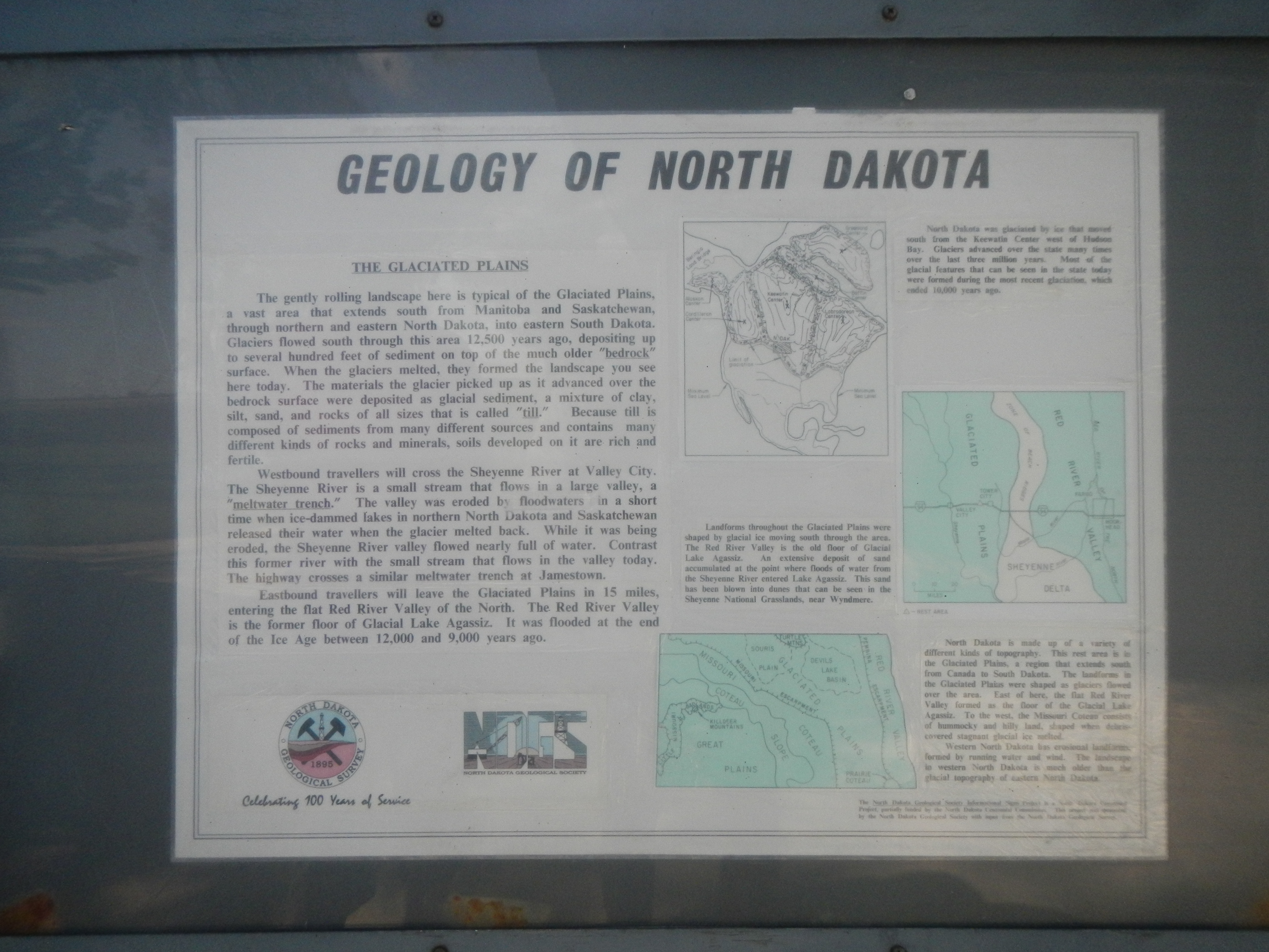
Geology of North Dakota Marker | Additional Description: Captions: (top right) North Dakota was glaciated by ice that moved south from the Keewatin Center west of Hudson Bay. Glaciers advanced over the state many times over the last three million years. Most of the glacial features that can be seen in the state today were formed during the most recent glaciation, which ended 10,00 years ago.; (middle right) Landforms throughout the Glaciated Plains were shaped by glacial ice moving south through the area. The Red River valley is the old floor of Glacial Lake Agassiz. An extensive deposit of sand accumulated at the point where floods of water from the Sheyenne River entered Lake Agassiz. This sand has been blown into dunes that can be seen in the Sheyenne National Grasslands, near Wyndmere.; (bottom right) North Dakota is made up of a variety of different kinds of topography. This rest area is in the Glaciated Plains, a region that extends south from Canada to South Dakota. The landforms in the Glaciated Plains were shaped as glaciers flowed over the area. East of here, the flat Red River Valley formed as the floor of the Glacial Lake Agassiz. To the west, the Missouri Coteau consists of hummocky and hilly land, shaped when debris-covered stagnant glacial ice melted. Western North Dakota has erosional landforms, formed by running water and wind. The landscape in western North Dakota is much older than the glacial topography of eastern North Dakota.
Submitted: December 20, 2020, by Barry Swackhamer of Brentwood, California.
Database Locator Identification Number: p558221
File Size: 3.787 Megabytes
To see the metadata that may be embedded in this photo, sign in and then return to this page.