Photograph as originally submitted to
this page in the Historical Marker Database
www.HMdb.org.
Click on photo to resize in browser. Scroll down to see metadata.
Photographer: Courtesy of Virginia Department of Conservation and Development.
Caption:
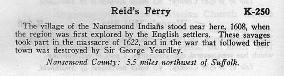
K-250 Reid’s Ferry, 1948. | Additional Description: The village of the Nansemond Indians stood near here, 1608, when the region was first explored by the English settlers. These savages took part in the massacre of 1622, and in the war that followed their town was destroyed by Sir George Yeardley.
Nansemond County: 5.5 miles northwest of Suffolk —State Historical Markers of Virginia, Sixth Edition (1948)Submitted: December 20, 2020, by Cynthia L. Clark of Suffolk, Virginia.
Database Locator Identification Number: p558243
File Size: 0.008 Megabytes
To see the metadata that may be embedded in this photo, sign in and then return to this page.